Search the Special Collections and Archives Portal
Search Results
Construction continues on Allegiant Stadium as seen from above Al Davis Way and Dean Martin Drive, looking south-southwest in Las Vegas, Nevada: digital photograph, 2020 February 07
Level of Description
Archival Collection
Collection Name: UNLV University Libraries Photographs of the Development of the Las Vegas Valley, Nevada
Box/Folder: N/A
Archival Component
A sidewalk on the east side of Eastern Avenue south of Grand Hills Drive with custom homes and no sidewalk on the west side, looking south-southwest in Henderson, Nevada: digital photograph, 2019 April 03
Level of Description
Archival Collection
Collection Name: UNLV University Libraries Photographs of the Development of the Las Vegas Valley, Nevada
Box/Folder: N/A
Archival Component
The Circa Las Vegas tower under construction behind the California hotel and casino as seen from Stewart Avenue, looking southwest in Las Vegas, Nevada: digital photograph, 2020 February 11
Level of Description
Archival Collection
Collection Name: UNLV University Libraries Photographs of the Development of the Las Vegas Valley, Nevada
Box/Folder: N/A
Archival Component
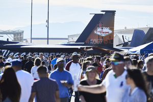
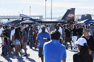
Crowds at the 2017 Aviation Nation Nellis Air and Space Expo pass by the Vegas Strong F-15C Eagle on display, looking southwest at Nellis Air Force Base in Nevada: digital photograph
Date
Archival Collection
Description
Following the October 1, 2017 killing of 58 people at the Route 91 Harvest Music Festival on the Las Vegas Strip, the Las Vegas community responded in a variety of ways. Nellis Air Force Base painted an F-15C Eagle in a Vegas Strong theme to recognize the Air Force's 70th Anniversary and show unity with the Las Vegas community.
Image
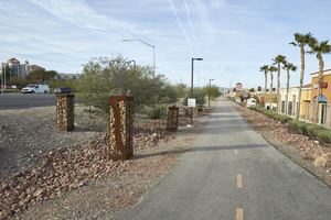
St. Rose Parkway Trail cuts along a commercial development on the north side of St. Rose Parkway near Eastern Avenue, looking southwest in Las Vegas, Nevada: digital photograph
Date
Archival Collection
Description
From the UNLV University Libraries Photographs of the Development of the Las Vegas Valley, Nevada (PH-00394). Part of the collection documents the entire 19 mile length of the north/south Eastern Avenue / Civic Center Drive alignment. This photograph was captured in the section of Eastern Avenue between Silverado Ranch Boulevard and Coronado Center Drive.
Image
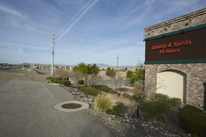
St. Rose Parkway Trail ends in an undeveloped lot on the north side of St. Rose Parkway west of Eastern Avenue, looking west-southwest in Las Vegas, Nevada: digital photograph
Date
Archival Collection
Description
From the UNLV University Libraries Photographs of the Development of the Las Vegas Valley, Nevada (PH-00394). Part of the collection documents the entire 19 mile length of the north/south Eastern Avenue / Civic Center Drive alignment. This photograph was captured in the section of Eastern Avenue between Silverado Ranch Boulevard and Coronado Center Drive.
Image
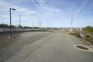
St. Rose Parkway Trail ends in an undeveloped lot on the north side of St. Rose Parkway west of Eastern Avenue, looking south-southwest in Las Vegas, Nevada: digital photograph
Date
Archival Collection
Description
From the UNLV University Libraries Photographs of the Development of the Las Vegas Valley, Nevada (PH-00394). Part of the collection documents the entire 19 mile length of the north/south Eastern Avenue / Civic Center Drive alignment. This photograph was captured in the section of Eastern Avenue between Silverado Ranch Boulevard and Coronado Center Drive.
Image
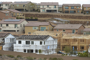
Lennar Development's Aventine neighborhood under construction as seen from Pecos Ridge Parkway west of Eastern Avenue with custom homes above, looking southwest in Henderson, Nevada: digital photograph
Date
Archival Collection
Description
From the UNLV University Libraries Photographs of the Development of the Las Vegas Valley, Nevada (PH-00394). Part of the collection documents the entire 19 mile length of the north/south Eastern Avenue / Civic Center Drive alignment. This photograph was captured in the section of Eastern Avenue between Sunridge Heights Parkway and Grand Hills Drive.
Image
