Search the Special Collections and Archives Portal
Search Results
Construction continues on the expansion of the Las Vegas Convention Center as seen from Paradise Road, looking southwest in Las Vegas, Nevada: digital photograph, 2019 May 30
Level of Description
Archival Collection
Collection Name: UNLV University Libraries Photographs of the Development of the Las Vegas Valley, Nevada
Box/Folder: N/A
Archival Component
The Circa Las Vegas tower under construction as seen from Ogden Avenue, looking west-southwest in Las Vegas, Nevada: digital photograph, 2020 February 11
Level of Description
Archival Collection
Collection Name: UNLV University Libraries Photographs of the Development of the Las Vegas Valley, Nevada
Box/Folder: N/A
Archival Component
Workers build on the Circa Las Vegas tower as seen from Ogden Avenue, looking west-southwest in Las Vegas, Nevada: digital photograph, 2020 February 11
Level of Description
Archival Collection
Collection Name: UNLV University Libraries Photographs of the Development of the Las Vegas Valley, Nevada
Box/Folder: N/A
Archival Component
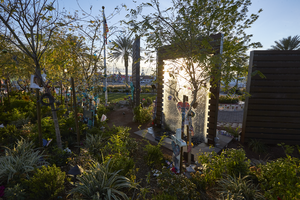
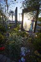
Late afternoon sunshine lights up the water feature at the Las Vegas Community Healing Garden, looking west-southwest in Las Vegas, Nevada: digital photograph
Date
Archival Collection
Description
Following the October 1, 2017 killing of 58 people at the Route 91 Harvest Music Festival on the Las Vegas Strip, the Las Vegas community responded in a variety of ways. Envisioned by activists and built by volunteers, the City of Las Vegas established the Las Vegas Community Healing Garden at 1015 S. Casino Center Boulevard to honor the victims and give family members and the community a place to gather to remember.
Image
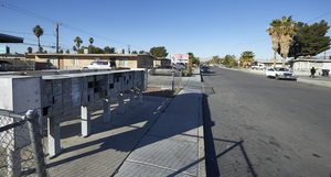
Mail boxes service a residential area on Civic Center Drive near Eastern Avenue, looking west-southwest in North Las Vegas, Nevada: digital photograph
Date
Archival Collection
Description
From the UNLV University Libraries Photographs of the Development of the Las Vegas Valley, Nevada (PH-00394). Part of the collection documents the entire 19 mile length of the north/south Eastern Avenue / Civic Center Drive alignment. This photograph was captured in the section of Civic Center Drive and Eastern Avenue between Lake Mead Boulevard and Washington Avenue.
Image
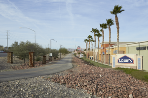
A portion of the St. Rose Parkway Trail next to commercial development as seen from Eastern Avenue, looking south-southwest in Las Vegas, Nevada: digital photograph
Date
Archival Collection
Description
From the UNLV University Libraries Photographs of the Development of the Las Vegas Valley, Nevada (PH-00394). Part of the collection documents the entire 19 mile length of the north/south Eastern Avenue / Civic Center Drive alignment. This photograph was captured in the section of Eastern Avenue between Silverado Ranch Boulevard and Coronado Center Drive.
Image
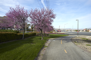
Landscaping in front of Dignity Health St. Rose Dominican Hospital on St. Rose Parkway near Eastern Avenue, looking southwest in Henderson, Nevada: digital photograph
Date
Archival Collection
Description
From the UNLV University Libraries Photographs of the Development of the Las Vegas Valley, Nevada (PH-00394). Part of the collection documents the entire 19 mile length of the north/south Eastern Avenue / Civic Center Drive alignment. This photograph was captured in the section of Eastern Avenue between Silverado Ranch Boulevard and Coronado Center Drive.
Image
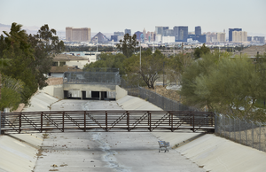
A flood control channel and with the Las Vegas skyline off St. Rose Parkway east of Eastern Avenue, looking west-southwest in Henderson, Nevada: digital photograph
Date
Archival Collection
Description
From the UNLV University Libraries Photographs of the Development of the Las Vegas Valley, Nevada (PH-00394). Part of the collection documents the entire 19 mile length of the north/south Eastern Avenue / Civic Center Drive alignment. This photograph was captured in the section of Eastern Avenue between Silverado Ranch Boulevard and Coronado Center Drive.
Image
