Search Results

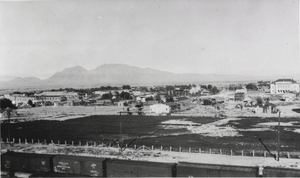
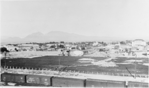
Photograph of the railroad yards, Las Vegas, circa 1913
Date
1912 to 1914
Archival Collection
Description
Black and white image of railroad yards in Las Vegas.
Image
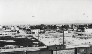
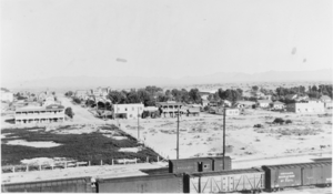
Photograph of the railroad yards, Las Vegas, circa 1913
Date
1912 to 1913
Archival Collection
Description
Black and white image of railroad yards in Las Vegas.
Image
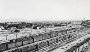
Photograph of the railroad yards, Las Vegas, circa 1913
Date
1912 to 1914
Archival Collection
Description
Black and white image of railroad yards in Las Vegas.
Image
Photograph of the railroad yards, Las Vegas, circa 1913
Date
1912 to 1914
Archival Collection
Description
Black and white image of railroad yards in Las Vegas.
Image
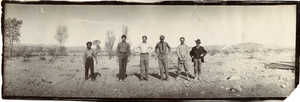
Photograph of six railroad construction workers in desert, 1903
Date
1903
Archival Collection
Description
Photograph of six railroad construction workers in desert, 1903
Image
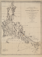
Map of explorations and surveys south of the Central Pacific Railroad made by the U.S. Army Corps of Topographical Engineers, 1871
Date
1871
Description
'Preliminary topographical map embracing in skeleton a portion only of the notes from surveys made in accordance with Par.II Special Orders No. 109 War Dept., March 18th, 1871 and letter of instructions of Brig. General A.A. Humphreys, Chief of Eng'rs. dated March 23rd, 1871. Conducted under the immediate direction of 1st Lieutenant Geo. M. Wheeler, Corps of Eng'rs., assisted by 1st Lieutenant D.W. Lockwood, Corps of Eng'rs. and 2nd Lieutentant D.A. Lyle, 2nd U.S. Artillery, during the summer and fall of 1871. Louis Nell, chief topographer and draughtsman.'' At head of map: 'Explorations in Nevada and Arizona. U.S. Engineer Department.' In lower left corner: 'Note: This map is a hasty and partial compilation from the topographical data already received, many still remaining en route. Upon it is projected in skeleton the groundwork of the area examined. All points except the prominent astronomical positiions are subject to lsight modification upon the final map.' Shows area through central Nevada, eastern California, and central Arizona. Relief shown by hachures. Published by the War Dept. Scale [ca. 1:1,520,640]. 1 in. to 24 miles (W 118°--W 109°/N 41°--N 32°).
Image
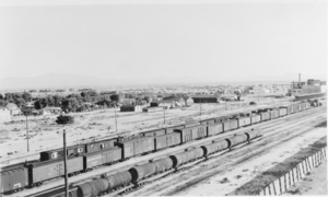
Film transparency of a railroad yard, Las Vegas, 1913
Date
1913
Archival Collection
Description
Black and white image of a railroad yard in Las Vegas, Nevada.
Image
Film transparency of a railroad yard, Las Vegas, 1913
Date
1913
Archival Collection
Description
Black and white image of a railroad yard in Las Vegas, Nevada.
Image
Film transparency of a railroad yard, Las Vegas, 1913
Date
1913
Archival Collection
Description
Black and white image of a railroad yard in Las Vegas, Nevada.
Image
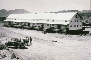
Slide of a railroad building in Boulder City, Nevada, April 10, 1931
Date
1931-04-10
Archival Collection
Description
Black and white image of men outside of a railroad building in Boulder City.
Image