Search Results

Map showing configuration of potentiometric surfaces in Paleozoic and Cenozoic aquifers in the area between the Las Vegas Valley and the Amargosa Desert, Nevada, 1963
Date
1963
Description
'Department of the Interior, United States Geological Survey. TEI-840.' 'Prepared in cooperation with the U.S. Atomic Energy Commission.' 'Contours in northwest Las Vegas Valley from Malmberg, 1961.' Relief shown by contours. Shows township and range lines. Scale [ca. 1:253,440. 1 in.=aprrox. 4 miles] (W 114°00´--W 115°00´--N 37°00´/N 36°00´). Originally published in A summary of the ground-water hydrology of the area between the Las Vegas Valley and the Amargosa Desert, Nevada : with special reference to the effects of possible new withdrawals of ground water / by Isaac J. Winograd, published by the U.S. Geological Survey in 1963 as number 840 of the Trace elements investigations report.
Image
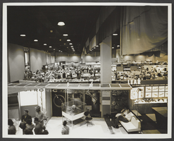
Photograph of Las Vegas Convention Center, Las Vegas, 1966
Date
1966
Archival Collection
Description
An interior view of people inside of the Las Vegas Convention Center display area in Las Vegas, Nevada.
Image
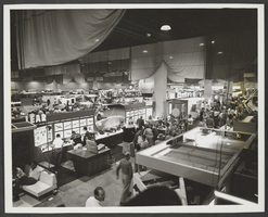
Photograph of Las Vegas Convention Center, Las Vegas, 1966
Date
1966
Archival Collection
Description
An interior view of people inside of the Las Vegas Convention Center display area in Las Vegas, Nevada.
Image
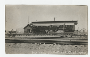
Postcard of the Las Vegas Depot, Las Vegas (Nev.), 1905
Date
1905
Archival Collection
Description
Postcard shows the San Pedro, Los Angeles and Salt Lake Railroad Depot of Las Vegas in 1905. Three signs on side of railcar state Pacific Express Co., Las Vegas, Ticket office.
Caption: Salt Lake Depot Las Vegas 1905
Caption: Salt Lake Depot Las Vegas 1905
Image
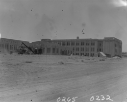
Film transparency of Las Vegas High School, Las Vegas, 1930
Date
1930
Archival Collection
Description
The Las Vegas High School under construction in Las Vegas, Nevada.
Image

Map of the city of Las Vegas, North Las Vegas, "the Strip," 1960
Date
1960
Description
1960 edition. 41 x 43 cm. Copyright held by Robert E. Barringer. Title in upper-right corner of map: Las Vegas area map. Irregularly-shaped map. Includes index, notes, list of Las Vegas schools and inset maps of East Las Vegas (Whitney) and Wherry housing area on Nellis Air Force Base. Original publisher: Redwood Publishing Co..
Image
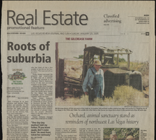
Las Vegas centennial news clippings
Date
2005-01-23
2005-05-15
2005-05-13
2005-05-20
2005-06
Archival Collection
Description
Las Vegas centennial news clippings
Text

Map showing proposed new 12" well and pipe line changes at Water Springs, Las Vegas, Nevada, circa 1920
Date
1916 to 1925
Archival Collection
Description
In lower right corner: '6-W-74.' Scale: 1" = 500'.
Image
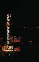
Slide of the Las Vegas Club, Las Vegas, December 1955
Date
1955-12
Archival Collection
Description
Las Vegas Club signs lit up at night on Fremont Street.
Image
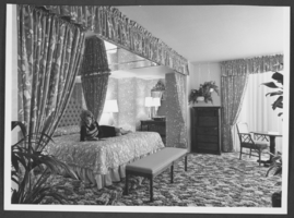
Photograph of a guest room in the Las Vegas Hilton, Las Vegas, Nevada, circa 1974-1975
Date
1974 to 1975
Archival Collection
Description
A woman poses in a guest room in the Las Vegas Hilton in Las Vegas, Nevada.
Image