Search Results
Hall, Marie, 1983 September 18
Level of Description
Archival Collection
Collection Name: Frank Mitrani Photographs
Box/Folder: Box 15
Archival Component
Hall, Fred, 1969 January 08
Level of Description
Archival Collection
Collection Name: Frank Mitrani Photographs
Box/Folder: Box 03
Archival Component
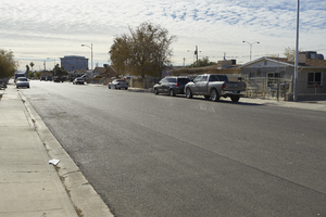
North Las Vegas City Hall is seen behind a residential neighborhood on Civic Center Drive in North Las Vegas, Nevada: digital photograph
Date
Archival Collection
Description
From the UNLV University Libraries Photographs of the Development of the Las Vegas Valley, Nevada (PH-00394). Part of the collection documents the entire 19 mile length of the north/south Eastern Avenue / Civic Center Drive alignment. This photograph was captured in the section of Civic Center Drive between Cheyenne Avenue and Las Vegas Boulevard.
Image
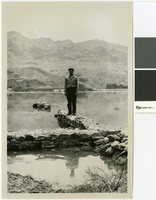
Photograph of Elbert Edwards at Fort Callville, Nevada, circa 1938
Date
Archival Collection
Description
Elbert Edwards standing on one of the walls of Fort Callville nearly surrounded by the rising waters of Lake Mead.
Transcribed Notes: Transcribed from photo sleeve: "Elbert Edwards at the ruins of Fort Callville as the waters of Lake Mead rise to cover them. (ca. 1938-39)"
Image
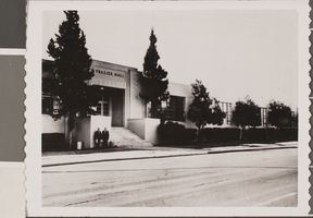
Photograph of Frazier Hall, Las Vegas, circa 1950s
Date
Archival Collection
Description
Description provided with image: "Frazier Hall at its first location (Las Vegas High School). It later moved to its present location on Maryland Parkway."
Image
Apartment development, 1938 Catalpa Ave., 1961
Level of Description
Archival Collection
Collection Name: Elmo C. Bruner Architectural and Real Estate Appraisal Records
Box/Folder: Box 78
Archival Component
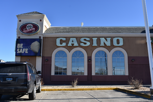
Pete's Gambling Hall wall mounted signs, Winnemucca, Nevada
Date
Archival Collection
Description
View of the wall mounted signs for Pete's Gambling Hall during the day with unlit neon.
1985 W Winnemucca Blvd, Winnemucca, NV 89445
Pete's Gambling Hall
Image
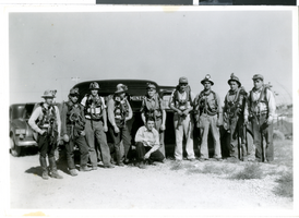
Photograph of miners in Tonopah (Nev.), circa 1938
Date
Archival Collection
Description
Image
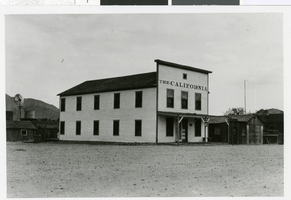
Photograph of the California, Beatty (Nev.), 1937-1938
Date
Archival Collection
Description
Image
Golden Nugget Gambling Hall, 1986
Level of Description
Archival Collection
Collection Name: Neon in Nevada Photograph Collection
Box/Folder: Binder PB-005
Archival Component