Search Results
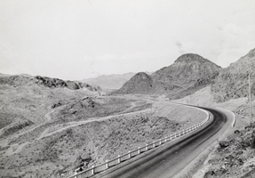
Photograph of a highway near Boulder City, Nevada, 1931
Date
1931
Archival Collection
Description
Highway near Boulder City, Nevada, 1931.
Image
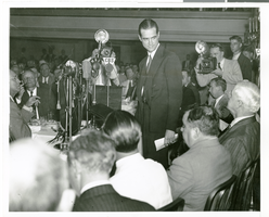
Photograph of Howard Hughes speaking at the National Press Club, New York City, July 15, 1938
Date
1938-07-15
Archival Collection
Description
Typed onto a piece of paper attached to the image: "Howard Hughes and his four companions honored at the National Press Club. Howard Hughes is speaking, with Mayor La Guardia and Secretary of State Cordell Hull at lower right. July 1938."
Image
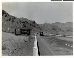
Photograph of sign on highway to Boulder City, 1940s-1950s
Date
1940 to 1959
Archival Collection
Description
Automobiles on the highway leading to Boulder City, Nevada. The sign to the left of the road reads, "Boulder City, Lake Mead Lodge, Lake Mead Boat Co."
Image

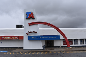
TA wall mounted signs, Mill City, Nevada
Date
2021
Archival Collection
Description
A wall mounted sign for the TA in Mill City with a detail shot of the welcome sign during the day.
6000 Frontage Rd, Mill City, NV 89418
TA
Image
"Origin and Growth of City Library", 1946
Level of Description
File
Archival Collection
Las Vegas City Commission Records
To request this item in person:
Collection Number: MS-00237
Collection Name: Las Vegas City Commission Records
Box/Folder: Box 01
Collection Name: Las Vegas City Commission Records
Box/Folder: Box 01
Archival Component
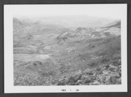
Photograph of area around Boulder City, Nevada, 1964
Date
1964
Archival Collection
Description
A view of environs around Boulder City, Nevada.
Image
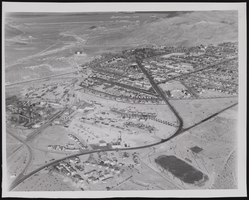
Photograph of Boulder City (Nev.), January 22, 1947
Date
1947-01-22
Archival Collection
Description
An oversized picture of an aerial view of Boulder City.
Image
Photograph of Boulder City (Nev.), 1947-01-22
Date
1947-01-22
Archival Collection
Description
An oversized picture of an aerial view of Boulder City.
Image
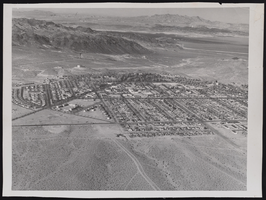
Photograph of Boulder City, Nevada, circa 1930-1940
Date
1930 to 1940
Archival Collection
Description
Picture of a Boulder City housing development facing north.
Image