Search the Special Collections and Archives Portal
Search Results
Series VIII. Miscellaneous notes, correspondence, books, and certificates, 1914 to 1974
Level of Description
Scope and Contents
The miscellaneous notes, correspondence, books, and certificates series (1914-1974) consists of photocopies of miscellaneous field notes written by Chester Longwell from 1919 to 1925; a list of Longwell's publications; notes on photographs and other collection provenance and acquisition information; recognition certificates and letters; and geology books.
Archival Collection
Collection Name: Chester R. Longwell Professional Papers
Box/Folder: N/A
Archival Component


Geographical and Geological Survey of the Rocky Mountain Region (U.S.)
No description.
Corporate Body

Drawing and descripton of zinc, ore, and barren shale: photographic prints
Date
Archival Collection
Description
Mixed Content
Lake Mead National Recreation Area maps, drawings, and brochures, 1947 to 1977
Level of Description
Scope and Contents
The Lake Mead National Recreation Area maps, drawings, and brochures series (1947-1977) includes topographic and rendered maps and brochures of Lake Mead and its vicinity. These maps and brochures typically depict local points of interest, geological survey information, and artists' depictions of the region's natural environment.
Archival Collection
Collection Name: UNLV University Libraries Collection of Boulder City, Hoover Dam, and Lake Mead National Recreation Area Maps and Brochures
Box/Folder: N/A
Archival Component

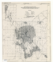
Map of part of Las Vegas Valley showing contours of the composite piezometric surface during the spring of 1944, and specific capacities of wells tapping the confined water
Date
Description
Relief shown by contours. Includes range and township grid. Shows springs and wells. Scale [ca. 1:67,162. 1 in. to approx. 1.06 miles]. Series: Water resources bulletin (Carson City, Nev.)
no. 5. Originally published as plate 8 in Geology and water resources of Las Vegas, Pahrump, and Indian Spring Valleys, Clark and Nye Counties, Nevada by George B. Maxey and C.H. Jameson, which is number 5 of the Water resources bulletin published by the Nevada Office of the State Engineer.
Image

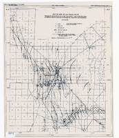
Map of part of Las Vegas Valley showing the piezometric surface of the "near-surface" water during the spring of 1946 by contours, and areas of discharge by evaporation and transpiration
Date
Description
Relief shown by contours. Includes range and township grid. Shows springs, wells and areas of discharge. Scale [ca. 1:67,162. 1 in. to approx. 1.06 miles]. Series: Water resources bulletin (Carson City, Nev.)
no. 5. Originally published as plate 7 in Geology and water resources of Las Vegas, Pahrump, and Indian Spring Valleys, Clark and Nye Counties, Nevada by George B. Maxey and C.H. Jameson, which is number 5 of the Water resources bulletin published by the Nevada Office of the State Engineer.
Image

Topographic map of Nevada-California, Las Vegas quadrangle, 1951
Date
Description
Image

