Search the Special Collections and Archives Portal
Search Results
University of Nevada, Las Vegas (UNLV) 26th commencement program
Date
Archival Collection
Description
Commencement program from University of Nevada, Las Vegas Commencement Programs and Graduation Lists (UA-00115).
Text
University of Nevada, Las Vegas (UNLV) College of Sciences and Mathematics Diploma Ceremony program
Date
Archival Collection
Description
Commencement program from University of Nevada, Las Vegas Commencement Programs and Graduation Lists (UA-00115).
Text
James "Dee" Donithan Collection of Nevada Test Site Photographs
Identifier
Abstract
The James "Dee" Donithan Collection of Nevada Test Site Photographs (approximately 1970-1999) consist of 8x10 photographs depicting flowers, landscapes, wildlife, workers, work sites, and testing equipment at the Nevada Test Site. The photographs were printed by the Lawrence Livermore National Laboratory in Mercury, Nevada, and collected into a binder by James "Dee" Donithan.
Archival Collection
University of Nevada, Las Vegas (UNLV) 15th commencement program
Date
Archival Collection
Description
Commencement program from University of Nevada, Las Vegas Commencement Programs and Graduation Lists (UA-00115).
Text
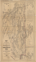
Map showing detailed topography of the country traversed by the reconnaissance expedition through southern & southeastern Nevada, 1869
Date
Description
no. 1.miles. Library's copy has counties hand-outlined in colored markers.
Image
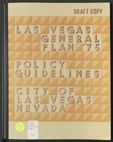
Las Vegas General Plan '75: policy guidelines
Date
Description
City of Las Vegas, Nevada general plan, draft copy.
From the introduction: "This is a document of policies. These policies are in the form of recommendations to the City of Las Vegas for planning policies in the areas of: Population and Economic Development, Land Use, Housing, Community Facilities, Conservation, Transportation, Parks and Recreation, Visual Environment, Implementation."
Text
Jeanne Russell Janish Photograph Collection
Identifier
Abstract
The Jeanne Russell Janish Photograph Collection (1918-1974) consists of 48 black-and-white and color photographic prints that feature Janish's family, her husband Carl Janish, family homes and pets, and travel photographs from the United States, China, and South America.
Archival Collection
Frank D. Rathbun Archaeology Papers
Identifier
Abstract
The Frank D. Rathbun Archaeology Papers (1918-1983) consist of photographs, field note books and sketchbooks reflecting Rathbun's interest in petroglyphs throughout Nevada, Arizona, and California. The materials also include high school yearbooks, school term papers, scrapbooks, postcards, and memos pertaining to Native American history, water projects, and engineering topics. Additionally included is an unpublished report of an archaeological survey of the petroglyph sites identified by Rathbun, conducted in 1968 by Michael Moen.
Archival Collection
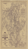
Map showing detailed topography of the country traversed by the reconnaissance expedition through southern & southeastern Nevada, 1869 (reproduction)
Date
Description
no. 1. Reproduction. Map is printed in purple. Scale of original map: [1:760,320]. 1 in. to approx. 12 miles. Includes dots hand-colored with red pencil marking Indian rancherias.
Image
Wells, Herbert C., 1927-2010
Herbert C. Wells was born April 11, 1927 in Omaha, Nebraska. After his father was killed in a plane crash in 1931, his mother moved herself and Wells to Los Angeles, California to be near her husband's parents. They moved several times, but the goal was always to find good schools for Wells and his sister.
Person
