Search Results
Economic Opportunity Board of Clark County (Nev.): rosters, correspondence
Date
1964 to 1970
Archival Collection
Description
From the Clark County Economic Opportunity Board Records -- Series I. Administrative. This folder contains reports, correspondence, and rosters of the Economic Opportunity Board of Clark County, Nevada from 1964 through 1970.
Text

Geologic map of the northeast quarter of the Bullfrog 15-minute quadrangle, Nye County, Nevada, 1990
Date
1990
Description
58 x 46 cm., on sheet 87 x 102 cm., folded in envelope 30 x 24 cm. Relief shown by contours and spot heights. "Contour interval 40 feet." "Base from U.S. Geological Survey 1:62,500. 1954." "Geology mapped in 1985 and 1988." Includes text, bibliography, 4 col. cross sections, and location and index maps. "Prepared in cooperation with the U. S. Atomic Commission." Original publisher: U. S. Geological Survey, Series: Miscellaneous investigations series, map I, Scale: 1:24 000.
Image
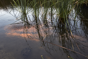
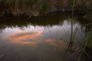
Clark County Wetlands Park, Clark County, Nevada: digital photograph
Date
2016-07-09
Archival Collection
Description
The sunset is reflected in a settling pond at the Clark County Wetlands Park.
Image
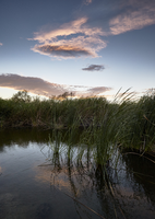
Clark County Wetlands Park, Clark County, Nevada: digital photograph
Date
2016-07-09
Archival Collection
Description
The sunset is reflected in a settling pond at the Clark County Wetlands Park.
Image
Clark County Wetlands Park, Clark County, Nevada: digital photograph
Date
2016-07-09
Archival Collection
Description
The sunset is reflected in a settling pond at the Clark County Wetlands Park.
Image

Map of Las Vegas Rancho, Lincoln County, Nevada, September 15, 1904
Date
1904-09-15
Description
'Being part of Township 20 S. R.61 E. MT. D. B.&.M, containing 1864.49 acres. Division engineer's office at the front, AMB, September 15th, 1904. A.L. Jones, Division Engineer. Surveyed by W.G. Watson, Assistant Engineer. Dwg. 30296.' Includes traverse table. Shows land owned by the San Pedro, Los Angeles & Salt Lake Railroad, its right of way and the right of way for the Las Vegas & Tonopah Railroad, land owned by the Las Vegas Land & Water Company including Clark's Las Vegas Townsite with the Bucks Addition and the Wardie Addition, and parcels sold from the Las Vegas Land & Water Company land. Scale: [1:9,600]. 1 in. to 800 feet. Library's copies 1 and 4 have land owned by the San Pedro, Los Angeles & Salt Lake Railroad hand-colored in pink and the rest of the Las Vegas Rancho not owned by the Las Vegas Land & Water Company hand-colored in green. Library's copy 2 has buildings of the Stewart Ranch drawn in and labeled in pencil. Library's copy 3 has addition and subtraction problems in pencil on the verso. Library's copy 4 has "Original purchase--1864.49 acres R.R.C. + L.V.L. + W. Co.--In colors." written in pencil on the verso followed by "(1904)" in red pencil. Library's copy 4 also has label on verson made of brown paper with "No 5 Las Vegas Ranch being part township ( 1904)" typed on it.
Image
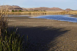
Clark County Wetlands Park, Clark County, Nevada: digital photograph
Date
2016-03-12
Archival Collection
Description
Water at the Clark County Wetlands Park rises and falls in settling ponds.
Image
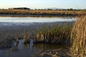
Clark County Wetlands Park, Clark County, Nevada: digital photograph
Date
2016-03-12
Archival Collection
Description
Vegetation flourishes along settling ponds at the Clark County Wetlands Park.
Image