Search the Special Collections and Archives Portal
Search Results
Las Vegas City Commission Minutes, November 20, 1957 to December 2, 1959
Date
1957-11-20 to 1959-12-02
Archival Collection
Description
Bound volume of Las Vegas City Commission Minutes, November 20, 1957 to December 2, 1959
Text
Las Vegas City Commission Minutes, November 7, 1949 to May 21, 1952
Date
1949-11-07 to 1952-05-21
Archival Collection
Description
Bound volume of Las Vegas City Commission Minutes, November 7, 1949 to May 21, 1952
Text
Las Vegas City Commission Minutes, February 17, 1937 to August 4, 1942
Date
1937-02-17 to 1942-08-04
Archival Collection
Description
Bound volume of Las Vegas City Commission Minutes, February 17, 1937 to August 4, 1942
Text
Las Vegas City Commission Minutes, January 7, 1947 to October 26, 1949
Date
1947-01-07 to 1949-10-26
Archival Collection
Description
Bound volume of Las Vegas City Commission Minutes, January 7, 1947 to October 26, 1949
Text
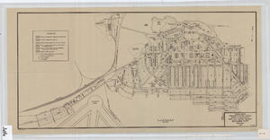
Cadastral map of Boulder City, Nevada, 1940
Date
1905-04-23
Description
A. M. S. Jan. 1940 in the lower left-hand corner. 1 map ; 61 x 30 cm. Cadastral map. "No. 40-1" in the lower right-hand corner. Shows block and lot numbers, buildings, water supply and sewage system, leased areas.
Image
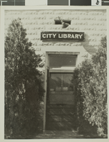
Photograph of Las Vegas City Library, 1943
Date
1943
Archival Collection
Description
The exterior of the Las Vegas City Library in Nevada.
Image
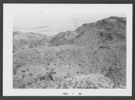
Photograph of Boulder City, Nevada, December 1964
Date
1964-12
Archival Collection
Description
Black and white photograph of mountains in Boulder City.
Image
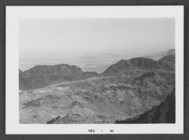
Photograph of Boulder City, Nevada, December 1964
Date
1964-12
Archival Collection
Description
Black and white photograph of mountains in Boulder City.
Image
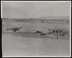
Photograph of an airport, Boulder City (Nev.), March 30, 1937
Date
1937-03-30
Archival Collection
Description
A photograph taken by Rupert B. Spearman of the hub of the Boulder City Airport as seen from the roof of the Grand Canyon Airlines hanger on March 30, 1937. Site Name: Boulder City Municipal Airport (Boulder City, Nev.)
Image
Pagination
Refine my results
Content Type
Creator or Contributor
Subject
Archival Collection
Digital Project
Resource Type
Year
Material Type
Place
Language
Records Classification

