Search the Special Collections and Archives Portal
Search Results
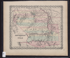
Map showing the territories of New Mexico and Utah, 1855
Date
1855
Description
'Entered according to Act of Congress in the year 1855 by J.H. Colton & Co. in the Clerk's Office of the Dist. Court of the U.S. for the South'n. Dist. of New York.' Scale [ca. 1:4,752,000. 1 in. to approx. 75 miles] (W 120°--W 102°/N 43°--N 32°). Shows natural features, and populated places, wagon route, proposed railroad routes and explorers' routes. Relief shown by hachures. Prime meridians: Greenwich and Washington.Hand colored. Atlas p. number in lower-right margin: 51. Decorative border. J.H. Colton & Co.
Image
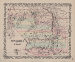
Map of territories of New Mexico and Utah, 1855
Date
1855
Description
29 x 36 cm. Shows natural features, and populated places, wagon route, proposed railroad routes and explorers' routes. Relief shown by hachures. Prime meridians: Greenwich and Washington. "Entered according to act of Congress in the year 1855 by J.H. Colton & Co in the Clerk's Office of the District Court of the U.S. for the Southern District of New York." Hand colored. Atlas p. number in lower-right margin: 51. Decorative border. The geographic region of Southwest is referred to as the New Southwest. Original publisher: J.H. Colton .
Image
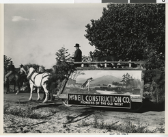
Photograph of McNeil Construction Co. Helldorado float, Las Vegas (Nev.), May 20, 1943
Date
1943-05-20
Archival Collection
Description
Black and white photograph of a Helldorado float leaving McNeil Ranch to go to the Helldorado parade. Men in cowboy hats ride horses ahead of the float. The float itself is pulled by horses and decorated with evergreen branches. On the side of the float there is an illustration of a cowboy on a horse in front of a lake, evergreen trees, mountains, and a covered wagon. The sign on the float reads: "McNeil Construction Co. Pioneers of the Old West." Inside the float there are donkeys and a man in a cowboy hat holding the horses' reins.
Image
Pagination
Refine my results
Content Type
Creator or Contributor
Subject
Archival Collection
Digital Project
Resource Type
Year
Material Type
Place
Language
Records Classification

