Search the Special Collections and Archives Portal
Search Results

Topographic map of groundwater in the southeast quadrangle of Las Vegas, Nevada, 1980
Date
Description
Text
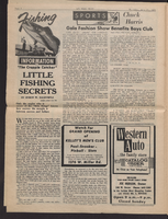
MS 95-47 Alice Key Collection. Box 1, Folder 07: Las Vegas Voice, July 21, 1966
Date
Archival Collection
Description
MS 95-47 Alice Key Collection. Box 1, Folder 07: Las Vegas Voice, July 21, 1966.
Text

Map of Las Vegas, Nevada and surrounding Bureau of Land Management areas to the west and north, 1994
Date
Description
Text
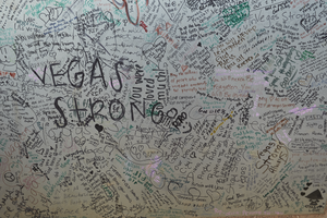
Messages, left as part of the 1 October memorial, cover a utility box near the Welcome to Las Vegas sign, looking west-southwest in Las Vegas, Nevada: digital photograph
Date
Archival Collection
Description
Following the October 1, 2017 killing of 58 people at the Route 91 Harvest Music Festival on the Las Vegas Strip, the Las Vegas community responded in a variety of ways. This series of photographs document the impromptu memorial created at the Welcome to Las Vegas sign.
Image
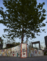
Hand painted tiles line the heart shaped planter box at the center of the Las Vegas Community Healing Garden, looking east in Las Vegas, Nevada: digital photograph
Date
Archival Collection
Description
Following the October 1, 2017 killing of 58 people at the Route 91 Harvest Music Festival on the Las Vegas Strip, the Las Vegas community responded in a variety of ways. Envisioned by activists and built by volunteers, the City of Las Vegas established the Las Vegas Community Healing Garden at 1015 S. Casino Center Boulevard to honor the victims and give family members and the community a place to gather to remember.
Image
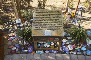
A box containing inscribed rocks for family members sits along the walkway at the Las Vegas Community Healing Garden, looking south in Las Vegas, Nevada: digital photograph
Date
Archival Collection
Description
Following the October 1, 2017 killing of 58 people at the Route 91 Harvest Music Festival on the Las Vegas Strip, the Las Vegas community responded in a variety of ways. Envisioned by activists and built by volunteers, the City of Las Vegas established the Las Vegas Community Healing Garden at 1015 S. Casino Center Boulevard to honor the victims and give family members and the community a place to gather to remember.
Image
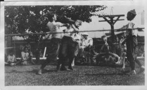
Unknown group of boys boxing: photographic print
Date
Archival Collection
Description
Dorothy Bell Scans UNLV-Public Lands Institute
Image
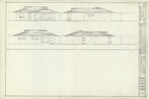
Architectural drawings of residential home in Las Vegas, Nevada, exterior elevations, 1955
Date
Archival Collection
Description
Drawings of exterior elevations of a ranch-style residential home in the Greater Las Vegas development in Las Vegas, Nevada. Handwritten underneath drawings at right: "Plan 14C - Elev. C."
Site Name: Greater Las Vegas
Image
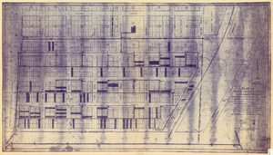
Plat of original townsite of Las Vegas, Clark County, Nevada, November 25, 1927
Date
Description
Subtitle: 'On N 1/2 of SW 1/4 section 27, T 20 S, R 61 E, M.D. Mer. showing cast iron water mains. Including location and distances of valves, fire hydrants, house connections, etc. Constructed by Las Vegas Land &Water Company. Construction completed Nov. 25-1927. Cast iron pipe system throughout made at Provo, Utah by Pacific States Cast Iron Pipe Company. R.N. Clark, Construction Engineer. Map and survey made by J.T. McWilliams, C.E., Las Vegas, Nev.' Map shows ownership of some parcels of land. Scale [ca. 1:960]. 1 inch to 80 feet. Blueline print. Plat map.
Image
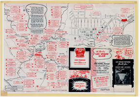
Map of Las Vegas, Nevada, July 1947
Date
Description
Text
