Search Results
Walking Box Ranch Photograph Collection
Identifier
Abstract
The Walking Box Ranch Collection (1880-1979, bulk 1930-1945) contains digital images compiled by the University of Nevada, Las Vegas (UNLV) Public Lands Institute. The collection consists of images of the Walking Box Ranch (Searchlight, Nevada), the Mojave Desert, and the Bell Family, consisting of American film stars Rex Bell, Clara Bow, and their children. There are also candid and professional photographs of Rex Bell and Clara Bow taken at various locations, some of which include friends and other family members, as well as a large number of unidentified film stills from Rex Bell movies. Images in this collection are from Bell family photograph albums and assorted prints, and were reformatted into digital images by the UNLV Public Lands Institute.
Archival Collection
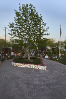
The heart shaped planter box at the Las Vegas Community Healing Garden, looking east-southeast in Las Vegas, Nevada: digital photograph
Date
Archival Collection
Description
Following the October 1, 2017 killing of 58 people at the Route 91 Harvest Music Festival on the Las Vegas Strip, the Las Vegas community responded in a variety of ways. Envisioned by activists and built by volunteers, the City of Las Vegas established the Las Vegas Community Healing Garden at 1015 S. Casino Center Boulevard to honor the victims and give family members and the community a place to gather to remember.
Image
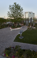
The heart shaped planter box at the Las Vegas Community Healing Garden, looking east-northeast in Las Vegas, Nevada: digital photograph
Date
Archival Collection
Description
Following the October 1, 2017 killing of 58 people at the Route 91 Harvest Music Festival on the Las Vegas Strip, the Las Vegas community responded in a variety of ways. Envisioned by activists and built by volunteers, the City of Las Vegas established the Las Vegas Community Healing Garden at 1015 S. Casino Center Boulevard to honor the victims and give family members and the community a place to gather to remember.
Image
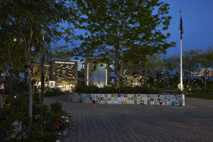
The heart shaped planter box at the Las Vegas Community Healing Garden, looking south-southwest in Las Vegas, Nevada: digital photograph
Date
Archival Collection
Description
Following the October 1, 2017 killing of 58 people at the Route 91 Harvest Music Festival on the Las Vegas Strip, the Las Vegas community responded in a variety of ways. Envisioned by activists and built by volunteers, the City of Las Vegas established the Las Vegas Community Healing Garden at 1015 S. Casino Center Boulevard to honor the victims and give family members and the community a place to gather to remember.
Image
General map of Las Vegas, Nevada, June 1962
Date
Description
Text
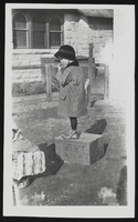
Unidentified child standing on a box: photographic print
Date
Archival Collection
Description
Image

Topographic map of Nevada-California, Las Vegas quadrangle, March 1908
Date
Description
Text
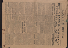
Newspaper, Las Vegas Review, July 27, 1923
Date
Description
Text

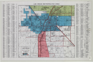
Map of metropolitan Las Vegas, Nevada area, circa 1957
Date
Description
Text

City of Las Vegas map, 1952
Date
Description
Text