
Search the Special Collections and Archives Portal

Search Results

Display    Results Per Page
Displaying results 631 - 640 of 780

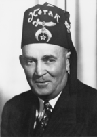
Gordon Bettles wearing his Masons fez: photographic print

Date

1950 to 1959

Description

From the Nye County, Nevada Photograph Collection (PH-00221) -- Series III. Beatty, Nevada -- Subseries III.A. Brockman Family. In the early 1950s, Gordon Bettles and his wife, Billie, moved into the abandoned T&T Ranch in the Amargosa Farm Area, Nye County, Nev. Bettles was the first occupant of the Farm Area since the closure of the T&T Railroad years before.

Image

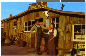
Postcard of Evan and Kathy Thompson in front of Tradin' Post, Rhyolite (Nev.), 1970s

Date

1970 to 1979

Description

A postcard of Even and Kathy Thompson standing in front of Tradin' Post in Rhyolite, Nevada. Typed description provided on back of postcard reads: "Rhyolite, Nevada. At the Trading Post. Evan and Kathy Thompson, youngest ghost of Rhyolite." Address stamped on back: "The Bottle House, Rhyolite Nevada, P. O. Box 93, Beatty, Nevada 89003." This postcard can possibly be credited to Desert Graphix, Trona, CA 93562.

Image

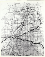
Photograph of a portion of a map of Southern California, circa 1920s

Date

1920 to 1929

Description

A portion of a map produced by the Automobile Club of Southern California During the early 1920s. The map was of San Bernardino County, California; this portion of the map shows roads and railroads and communities in the Barstow, California, area. Of particular interest is the railroad linking Tonopah and Tide Water Railroad with the Santa Fe tracks at Ludlow, California, and the stops on the T&T between Ludlow and Riggs, north of Silver Lake, California. (Courtesy of Claudia Reidhead, Beatty, Nevada.)

Image

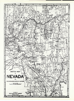
Photograph of a sketch map of Nevada and a portion of Southeastern California, 1906

Date

1906

Description

A map of Southern California and Southwestern Nevada prepared by the map department of the Automobile Club of Southern California, 1906. This map shows the development of roads, railroads, and communites in the Southcentral Nevada and Death Valley areas. This map seems to be identical to that pictured in 0734 of this collection, although this photograph provides more Coverage of the Mojave Desert area. Note the many springs listed in the south Central Nevada area. (Courtesy of Claudia Reidhead, Beatty, Nevada.)

Image

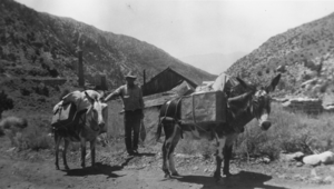
Burros carrying freight in Panamint City, California: photographic print

Date

1940 to 1943

Description

From the Nye County, Nevada Photograph Collection (PH-00221) -- Series III. Beatty, Nevada -- Subseries III.B. Lisle Family. By this time Panamint City was pretty much a ghost town, but Ralph Lisle and his partners lived here while working a nearby tungsten mine. Because there was no road from Panamint City to the Mine, all transporting was done by burros, shown here loaded with cargo. 

Image