Search Results
Aerial view of the Las Vegas quadrant in Arizona-Nevada: photographic print
Date
1950
Archival Collection
Description
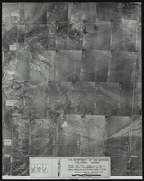
From the Army Mapping Service Aerial Photographs of Southern and Western Nevada (PH-00285). Aerial photographs, composites, and indices. High altitude aerial photographs, Quad. Las Vegas 3. State: Arizona - Nevada. U.S. Geologial Survey, Army Map Service. Flight Scale I-47200Project-GS-LJ. Index copied -8-26-50. Flying Comp. -7-26-50
Image
Aerial view of the Las Vegas quadrant in Arizona-Nevada: photographic print
Date
1950
Archival Collection
Description
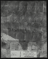
From the Army Mapping Service Aerial Photographs of Southern and Western Nevada (PH-00285). Aerial photographs, composites, and indices. High altitude aerial photographs, Quad. Las Vegas 1. State: Arizona - Nevada. U.S. Geologial Survey, Army Map Service. Flight Scale I-47200Project-GS-LJ. Index copied -8-26-50. Flying Comp. -7-26-50
Image
Aerial photograph of Lake Mead, 1940s-1950s
Date
1940 to 1959
Archival Collection
Description
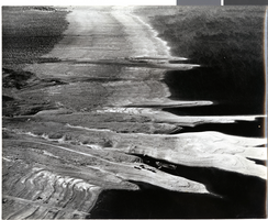
Aerial photo of Lake Mead. Towards the bottom center of the photo, cars and boats can be seen.
Image
Film transparency of aerial view of completed Hoover Dam, circa 1935
Date
1935
Archival Collection
Description
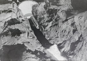
An aerial showing diversion tunnels in use on the completed dam.
Image
#12709 Aerials of the Strip including Convention Center (copy of 1960 negs): aerial photographs, approximate
Level of Description
File
Archival Collection
Frank Mitrani Photographs
To request this item in person:
Collection Number: PH-00332
Collection Name: Frank Mitrani Photographs
Box/Folder: Box 75
Collection Name: Frank Mitrani Photographs
Box/Folder: Box 75
Archival Component
#15928 Aerials for Turegun & Associates company brochure: aerial photographs, 1975 June 16
Level of Description
File
Archival Collection
Frank Mitrani Photographs
To request this item in person:
Collection Number: PH-00332
Collection Name: Frank Mitrani Photographs
Box/Folder: Box 76
Collection Name: Frank Mitrani Photographs
Box/Folder: Box 76
Archival Component
#01204: Campus Aerial taken by Cooper Aerial Surveys, Tucson Arizona, 1974 February 02
Level of Description
File
Archival Collection
University of Nevada, Las Vegas Creative Services Records (1970s)
To request this item in person:
Collection Number: PH-00388-01
Collection Name: University of Nevada, Las Vegas Creative Services Records (1970s)
Box/Folder: N/A
Collection Name: University of Nevada, Las Vegas Creative Services Records (1970s)
Box/Folder: N/A
Archival Component
#17386D Aerials of Henderson Industrial complex and Vegas wash: aerial photographs, 1977 June 28
Level of Description
File
Archival Collection
Frank Mitrani Photographs
To request this item in person:
Collection Number: PH-00332
Collection Name: Frank Mitrani Photographs
Box/Folder: Box 76
Collection Name: Frank Mitrani Photographs
Box/Folder: Box 76
Archival Component

A daytime aerial view of the Las Vegas Strip: photographic film
Date
1960 (year approximate) to 1986 (year approximate)
Archival Collection
Description
A daytime aerial view of the of Las Vegas Strip. The view is from the Hotel Flamingo looking north. For a similar view at night see Source ID 0220_0014, Digital ID pho026248. For a southern view at night see Source ID 0220_0015, Digital ID pho026249.
Image
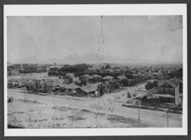
Aerial photograph of Las Vegas, circa 1920s
Date
1920 to 1929
Archival Collection
Description
A bird's eye view of Main and Bonneville Streets in Las Vegas, Nevada.
Image