Search Results
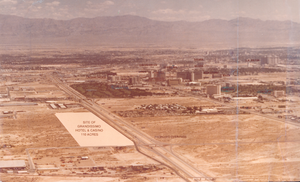
Aerial photograph of proposed site for Grandissimo Hotel, Las Vegas, Nevada, circa 1980
Date
Archival Collection
Description
Image

Aerial photograph of McGill, Nevada, circa early to mid 1900s
Date
Archival Collection
Description
Image
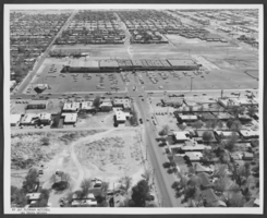
Aerial photograph of the Charleston Plaza shopping center, Las Vegas, Nevada, circa 1963
Date
Archival Collection
Description
Image

Aerial photograph snow around El Rancho Vegas, late 1940s
Date
Archival Collection
Description
Aerial view looking west of the El Rancho Vegas in the late 1940s. Note the snow on the ground.
Image
Aerial views of the Sahara and Las Vegas Strip (day): video, 1985
Level of Description
Scope and Contents
B-roll aerial footage taken from a helicopter of the Las Vegas Strip during the day; views of Silverbird and the entire Las Vegas Strip, and then mostly 360 views of the Sahara Hotel. Includes shots of the Landmark and Hilton International, and the Las Vegas Convention Center. Original media U-matic S, color, aspect ratio 4 x 3, frame size 720 x 486.
Archival Collection
Collection Name: The Production Company Audiovisual Collection
Box/Folder: Digital File 00
Archival Component
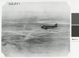
Aerial photograph of airplane and Las Vegas Airfield, Nevada, circa 1940
Date
Archival Collection
Description
Aerial view of an airplane and the Las Vegas Airstrip before the Army Air Corps took over the fields.
Image
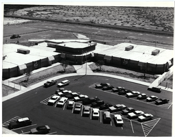
Aerial photograph of Elbert Edwards Elementary School, Las Vegas, Nevada, circa 1970s-1980s
Date
Archival Collection
Description
Image
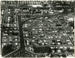
Aerial photograph of postwar housing in Coral Gables, Florida, circa 1950s
Date
Archival Collection
Description
Image
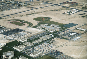
Slide of aerial view of University of Nevada, Las Vegas campus, circa 1975-1976
Date
Archival Collection
Description
Image
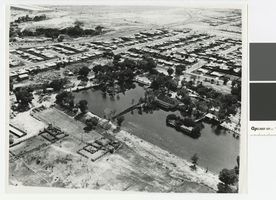
Aerial photograph of Twin Lakes/Lorenzi Park. Las Vegas, 1965
Date
Archival Collection
Description
Aerial view of Twin Lakes/Lorenzi Park in 1965.
Transcribed Notes: Stamped on back: Photos by Ken Jones
Image