Search Results
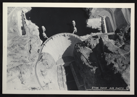
Aerial photograph of Hoover Dam, circa mid 1930s
Date
1935 to 1936
Archival Collection
Description
An image showing an aerial view of Hoover Dam. Note: Boulder Dam was officially renamed Hoover Dam in 1947.
Image

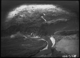
Film transparency of an aerial view of the Colorado River, circa 1930s
Date
1930 to 1939
Archival Collection
Description
Aerial view of the Colorado River printed on nitrate film.
Image
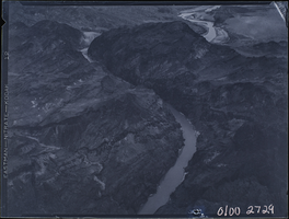
Film transparency of an aerial view of the Colorado River, circa 1930s
Date
1930 to 1939
Archival Collection
Description
Aerial view of the Colorado River printed on nitrate film.
Image
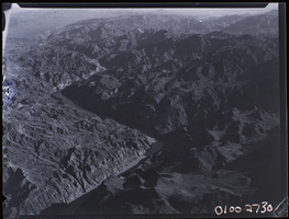
Film transparency of an aerial view of the Colorado River, circa 1930s
Date
1930 to 1939
Archival Collection
Description
Aerial view of the Colorado River printed on nitrate film.
Image
Film transparency of an aerial view of the Colorado River, circa 1930s
Date
1930 to 1939
Archival Collection
Description
Aerial view of the Colorado River printed on nitrate film.
Image
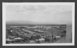
Aerial photograph of Boulder City, Nevada, 1933
Date
1933
Archival Collection
Description
An aerial view of Boulder City, Nevada.
Image
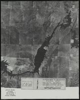
Aerial view of the Bonelli quadrant in Arizona-Nevada: photographic print
Date
1950
Archival Collection
Description
From the Army Mapping Service Aerial Photographs of Southern and Western Nevada (PH-00285). Aerial photographs, composites, and indices. Aerial photographs, Quad. Bonelli 4, U.S. Department of the Interior Geological Survey, Army Map Service. State: Arizona - Nevada. Flight Scale I-47200Project-GS-LJ. Index copied -8-26-50. Flying Comp. -7-26-50
Image
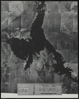
Aerial view of the Bonelli quadrant in Arizona-Nevada: photographic print
Date
1952
Archival Collection
Description
From the Army Mapping Service Aerial Photographs of Southern and Western Nevada (PH-00285). Aerial photographs, composites, and indices. High altitude aerial photographs, Quad. Bonelli 3, State: Arizona - Nevada. U.S. Geological Survey, Army Map Service. Flight Scale I-47200Project-GS-LJ. Index copied -8-26-50. Flying Comp. -7-26-50
Image
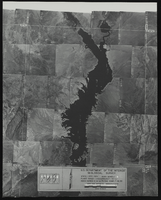
Aerial view of the Bonelli quadrant in Arizona-Nevada: photographic print
Date
1950
Archival Collection
Description
From the Army Mapping Service Aerial Photographs of Southern and Western Nevada (PH-00285). Aerial photographs, composites, and indices. High altitude aerial photographs, Quad. Bonelli, State: Arizona - Nevada. U.S. Geological Survey, Army Map Service. Flight Scale I-47200Project-GS-LJ. Index copied -8-26-50. Flying Comp. -7-26-50
Image
Maps, blueprints, aerial photographs
Level of Description
File
Archival Collection
Blue Diamond Mine Corporate Records
To request this item in person:
Collection Number: MS-00505
Collection Name: Blue Diamond Mine Corporate Records
Box/Folder: N/A
Collection Name: Blue Diamond Mine Corporate Records
Box/Folder: N/A
Archival Component