Search the Special Collections and Archives Portal
Search Results
Nevada Superintendent of State Printing Reports
Identifier
Abstract
Nevada Superintendent of State Printing Reports contain biennial reports from 1905-1906, 1938-1940, 1951-1952, and 1961 through 1970. (Also called the Report of the State Printer for the years 1964 to 1966.) Material includes records of printing done for elected and appointed officials in Nevada.
Archival Collection
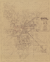
Las Vegas Valley map, Clark County, Nevada, June 1958
Date
Description
Image
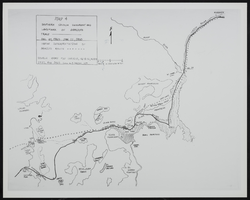
Map of Southen Nevada Geography: map
Date
Archival Collection
Description
Image
Balloon route excursion party, National Soldiers Home, Sawtelle, California. Jim Jeffries, C. A. Rinker, Rinker's girlfriend (identified from left to right): photographic print, approximately 1900-1910
Level of Description
Archival Collection
Collection Name: C. A. Earle Rinker Photograph Collection of Goldfield, Nevada
Box/Folder: Folder 06
Archival Component
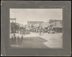
People outside in Goldfield and Tonopah, Nevada: photographic prints
Date
Archival Collection
Description
Image

Epilogue: Nevada Southern University Yearbook, 1959
Date
Description
Yearbook main highlights: schools and departments; detailed lists with names and headshots of faculty, administration and students; variety of photos from activities, festivals, campus life, and buildings; campus organizations such as sororities, fraternities and councils; beauty contest winners; college sports and featured athletes; and printed advertisements of local businesses; Institution name: Nevada Southern University, Las Vegas, NV
Mixed Content
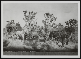
Stagecoach in Nevada, image 001: photographic print
Date
Archival Collection
Description
Image
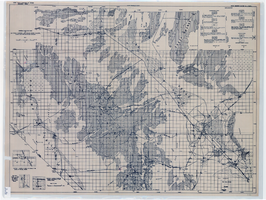
General geologic map of Las Vegas, Pahrump, and Indian Spring Valleys, Clark and Nye Counties, Nevada, 1948
Date
Description
At top of map: 'United States Department of the Interior, Geological Survey. State Engineer of Nevada. Water resources bulletin No. 5, Plate 1.' Relief shown by spot heights. Includes 3 inset maps of wells and springs in the vicinity of Pahrump, Manse Ranch and Indian Springs, Nevada. Scale [ca. 1:126,720. 1 inch to approx. 2 miles] (W 116°--W 115°/N 40°--N 36°). Originally published as plate 1 in Geology and water resources of Las Vegas, Pahrump, and Indian Spring Valleys, Clark and Nye Counties, Nevada by George B. Maxey and C.H. Jameson (1948), which is number 5 of the Water resources bulletin published by the Nevada Office of the State Engineer.
Image
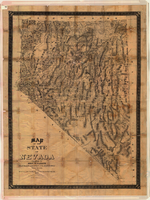
Map of the state of Nevada, 1886
Date
Description
Image
Album 9: the Park families in Las Vegas, Nevada, Austin, Nevada, and the Lost City Ranch: photographic prints
Date
Archival Collection
Description
Image
