Search the Special Collections and Archives Portal
Search Results
Nevada State Museum archaeology reports
Date
1963-11
1963-10
1963-09
1963-08
1963-07
1963-06
1963-05
1963-04
1963-03
1963-08-02
1963-08-06
Archival Collection
Description
Charles Rozaire's monthly reports as curator of archaeology at the Nevada State Museum. Also included is a site survey record from Washoe, a hand drawn site exacavation map, an archaeological stratigraphy record, a daily field record, and a pictograph record from Wall Canyon Ranch.
Text
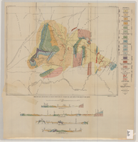
Geologic map and sections of Muddy Mountains, St. Thomas Gap, and part of the Grand Wash Cliffs, 1928
Date
1928
Description
'Geology by C.R. Longwell.' At top of map: 'U.S. Geological Survey Bulletin 798, plate 1.' Includes four colored cross-sections. 1:250,000 (W 115°00'--W 113°45'/N 36°45'--N 36°00'). Series: Bulletin (Geological Survey (U.S.)
no. 798. Originally published as plate 1 in: Geology of the Muddy Mountains, Nevada, with a sections through the Virgin Range to the Grand Wash Cliffs, Arizona / by Chester R. Longwell. Washington, D.C. : Government Printing Office, 1928. (Bulletin ((Geological Survey (U.S.)), no. 798).
no. 798. Originally published as plate 1 in: Geology of the Muddy Mountains, Nevada, with a sections through the Virgin Range to the Grand Wash Cliffs, Arizona / by Chester R. Longwell. Washington, D.C. : Government Printing Office, 1928. (Bulletin ((Geological Survey (U.S.)), no. 798).
Image
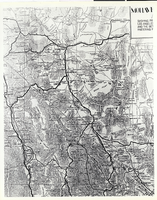
Photograph of a portion of a map of the state of Nevada, 1906
Date
1906
Archival Collection
Description
A portion of a map of the state of Nevada published by the Clason Map Co., Denver, Colorado, copyrighted 1906. Note the routes of the railroads in the southern Nevada area, including the Las Vegas and Tonopah Railroad linking the small community of Las Vegas with Beatty; (More information on the map is contained on the photo board.) (Courtesy, Central Nevada Museum, Tonopah, Nevada.)
Image
University of Nevada, Las Vegas Campus and Grounds, 1969-1982
Level of Description
Series
Scope and Contents
The University of Nevada, Las Vegas Campus and Grounds Series contains information about the physical grounds of the University of Nevada, Las Vegas (UNLV). The series is comprised primarily of reports and correspondence relating to UNLV police, parking and traffic, art on campus, the Thomas and Mack center, and Architecture and Engineering reports.
Archival Collection
University of Nevada, Las Vegas Office of the Vice President for Development and University Relations Records
To request this item in person:
Collection Number: UA-00047
Collection Name: University of Nevada, Las Vegas Office of the Vice President for Development and University Relations Records
Box/Folder: N/A
Collection Name: University of Nevada, Las Vegas Office of the Vice President for Development and University Relations Records
Box/Folder: N/A
Archival Component
Meeting minutes for Consolidated Student Senate University of Nevada, Las Vegas, September 12, 1991
Date
1991-09-12
Archival Collection
Description
Includes meeting agenda and minutes. CSUN Session 21 Meeting Minutes and Agendas.
Text
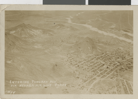
Postcard of aerial view of Tonopha, Nevada, 1932
Date
1932
Archival Collection
Description
A picture postcard showing an aerial view of Tonopah, Nevada. Caption: "Entering Tonopah, Nev. via Nevada Air Line plane. #44."
Image
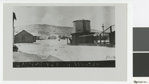
Photograph of winter landscape in Goodsprings, Nevada, 1928
Date
1928
Archival Collection
Description
Buildings and water tank in Goodsprings, Nevada.
Image
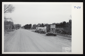
Postcard of Overton, Nevada, circa 1920s-1955
Date
1920 to 1955
Archival Collection
Description
Photograph of Main Street in Overton, Nevada.
Image
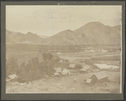
Photograph of a team or camp, Nevada, August 1901
Date
1901-08
Archival Collection
Description
An unidentified team or camp stationed in Nevada.
Image
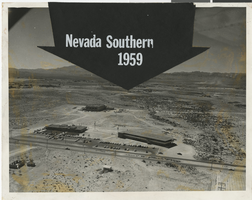
Aerial photograph of Nevada Southern University, 1959
Date
1959
Archival Collection
Description
Aerial view of Nevada Southern University.
Image
Pagination
Refine my results
Content Type
Creator or Contributor
Subject
Archival Collection
Digital Project
Resource Type
Year
Material Type
Place
Language
Records Classification
