Search Results
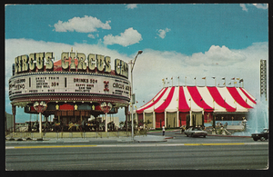
Circus Circus in Las Vegas, Nevada: postcard
Date
1940 (year approximate) to 1990 (year approximate)
Archival Collection
Description
From the Harvey's Hotel and Casino Postcard Collection (PH-00367) -- Carousel and tent of the Circus Circus Casino in Las Vegas, Nevada.
Image
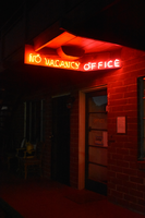
No Vacancy mounted sign, Reno, Nevada
Date
2016 (year approximate) to 2020 (year approximate)
Archival Collection
Description
A lit sign reading "No Vacancy" and "Office" for an unknown motel.
Image

ECV window sign, Reno, Nevada
Date
2016 (year approximate) to 2020 (year approximate)
Archival Collection
Description
The ECV sign while lit.
Image
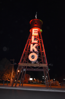
Chilton Centennial Tower, Elko, Nevada
Date
2016 (year approximate) to 2020 (year approximate)
Archival Collection
Description
View of the Chilton Centennial Tower during the day and at night.
Image
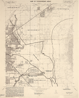
Maps of flood-prone areas in Las Vegas, Nevada, 1973
Date
1973
Description
'Prepared by the U.S. Department of the Interior, Geological Survey, in cooperation with the U.S. Department of Housing and Urban Development, Federal Insurance Administration. 1973.' Sheet 1: Las Vegas NE, Nev.; Sheet 2: Las Vegas SE, Nev.; Sheet 3:Las Vegas SW, Nev.; Sheet 4: Las Vegas NW, Nev. Published by Geological Survey (U.S.). Scale 1:24,000. [1 in. to approx. 2,000 ft.]. Relief shown by contours. Flood information overprinted on U.S. Geological Survey 7.5 minute topographic quadrangles: [sheet 1] Las Vegas NE quadrangle, [sheet 2] Las Vegas SE quadrangle, [sheet 3] Las Vegas SW quadrangle, [sheet 4] Las Vegas NW quadrangle, 1967. Shows areas subject to flooding by a flood that has 1 in 100 chance on the average of occurring in any one year. "Flood boundaries were estimated from: regional stage-frequency relations." Includes notes.
Image
Meeting minutes for Consolidated Student Senate University of Nevada, Las Vegas, October 26, 1989
Date
1989-10-26
Archival Collection
Description
Includes meeting agenda and minutes. CSUN Session 19 Meeting Minutes and Agendas.
Text
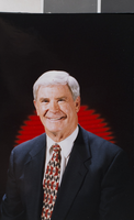
Photographs of Dr. Kenny Guinn, University of Nevada, Las Vegas, circa late 1990s
Date
1995 to 1999
Archival Collection
Description
Portraits of Dr. Kenny Guinn at the University of Nevada, Las Vegas (UNLV). He was interim president of UNLV for one year.
Image

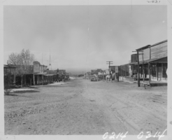
Photograph of businesses in Searchlight, Nevada, circa 1910s
Date
1910 to 1919
Archival Collection
Description
Main business district of Searchlight Nevada. Both horses and automobiles are in the street.
Image
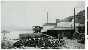
Photograph of the Old Gold stamp mill at Eldorado Canyon Techatticup Mine, Searchlight, Nevada, circa 1930s
Date
1930 to 1939
Archival Collection
Description
1800-1900 Old Gold stamp mill Eldorado Canyon Techatticup Mine in Searchlight, Nevada
Image