Search the Special Collections and Archives Portal
Search Results
Emma and William N. Schuyler (left) and Jack and Caroline Heaton in Denver, Colorado. Caroline is Emma’s sister (Caroline Schaefle) and was prominent in the Las Vegas real estate market in 1930s and 1940s: photographic print, approximately 1900
Level of Description
Archival Collection
Collection Name: Schuyler Family Photograph Collection
Box/Folder: Digital File 00
Archival Component
Nevada Watercolor Society Records
Identifier
Abstract
The Nevada Watercolor Society Records (1969-2009) contain watercolor paintings and organizational records pertaining to the Nevada Watercolor Society, a non-profit organization that aims to promote watermedia painting and art appreciation. Organizational records contain materials including by-laws, articles of incorporation, newsletters, exhibit information, tax and financial records, receipts, photographs, negatives, and newspaper clippings. The collection also includes paintings by society members and newspaper clippings about art exhibitions and artists in Las Vegas, Nevada.
Archival Collection
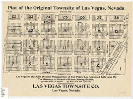
Plat of the original townsite of Las Vegas, Nevada, circa 1905
Date
Description
'Las Vegas is the main division headquarters of San Pedro, Los Angeles & Salt Lake Ry. The gateway to Nevada's richest mining section. 336 miles from Los Angeles. 444 miles from Salt Lake City.' Second copy available in the J.T. McWilliams manuscript collection.
Image
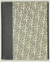
Epilogue: Nevada Southern University Yearbook, 1964
Date
Description
Yearbook main highlights: schools and departments; detailed lists with names and headshots of faculty, administration and students; variety of photos from activities, festivals, campus life, and buildings; campus organizations such as sororities, fraternities and councils; beauty contest winners; college sports and featured athletes; and printed advertisements of local businesses; Institution name: Nevada Southern University, Las Vegas, NV
Mixed Content
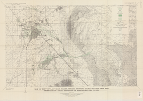
Map of part of Las Vegas Valley, Nevada, showing types, distribution, and approximate areal densities of phreatophytes in 1955
Date
Description
Image
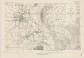
Map of part of Las Vegas Valley, Nevada, showing approximate area of phreatophytes before ground-water development
Date
Description
Image
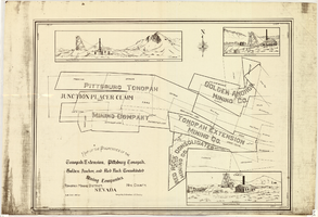
Map of properties in the Tonopah Mining District, Nye County, Nevada, circa 1901
Date
Description
Image
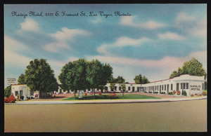
Artistic rendition of the Navajo Motel in Las Vegas, Nevada: postcard
Date
Archival Collection
Description
Image
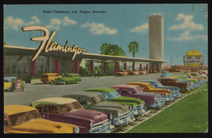
Artistic rendition of the Hotel Flamingo in Las Vegas, Nevada: postcard
Date
Archival Collection
Description
Image

