Search the Special Collections and Archives Portal
Search Results
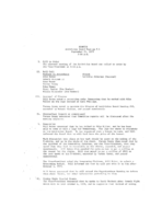
Meeting minutes for Consolidated Student Activities Board, University of Nevada, Las Vegas, September 25, 1978
Date
Archival Collection
Description
Text
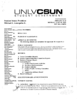
Meeting minutes for Consolidated Student Senate, University of Nevada, Las Vegas, April 11, 2005
Date
Archival Collection
Description
Text
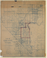
Map of Clark County, Nevada, 1927
Date
Description
Image

Meeting minutes for Consolidated Student Senate, University of Nevada, Las Vegas, September 17, 2007
Date
Archival Collection
Description
Text
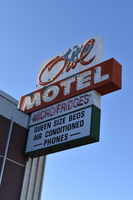
Owl Motel roof and wall mounted signs, Battle Mountain, Nevada
Date
Archival Collection
Description
View of the roof and wall mounted signs for the Owl Motel, a part of the Owl Club Casino & Restaurant, during the day with unlit neon.
72 E Front St, Battle Mountain, NV 89820
Owl Club Casino & Restaurant
Image
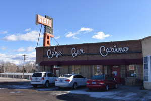
State Inn Cafe roof and wall mounted sign, Carlin, Nevada
Date
Archival Collection
Description
Views of the roof and wall mounted signs for the State Inn, including closeups of each sign during the day with unlit neon.
915 Chestnut Street, Box998, Carlin, NV 89822
State Inn Cafe
Image
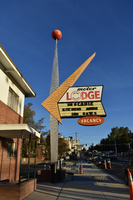
Silver Dollar Motor Lodge flag mounted sign, Reno Nevada
Date
Archival Collection
Description
View of the flag mounted sign for the Silver Dollar Motor Lodge during the day with unlit neon, including a view of the painted sign above the office.
817 N Virginia St, Reno, NV 89501
Silver Dollar Motor Lodge
Image
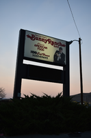
Moonlite BunnyRanch wall mounted and electric signs, Carson City, Nevada
Date
Archival Collection
Description
Views of the wall mounted neon sign for the Moonlite BunnyRanch at dusk with lit neon, including views of the electrical signs advertising the bar and restaurant.
69 Moonlight Rd, Carson City, NV 89706
Moonlight Bunny Ranch
Image
