Search the Special Collections and Archives Portal
Search Results
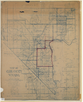
Map of Clark County, Nevada, 1927
Date
1927
Description
'Compiled by J.T. McWilliams from official county records, U.S. Land Dept. surveys, railroad co. field maps and many personal surveys. Made in 1927 by J.T. McWilliams, C.E.' Includes township and road districts, school districts, mining districts, railroads, wagon roads, trails, springs and artesian wells. Scale [ca. 1:316,800. 1 in. to approx. 5 miles] (W 116°--W 114°/N37--N35). Relief shown by hachures. Blueline print. Library's copy 1 has one area outlined by hand in red. Library's copy 2 has school districts outlined in red and green pencil and labeled in pencil by hand.
Image

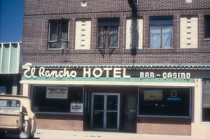
Slide of the El Rancho Hotel, Wells, Nevada, 1986
Date
1986
Archival Collection
Description
An image of the exterior of the El Rancho Hotel located in Wells, Nevada. The white neon sign above the entrance of the building reads: "El Rancho Hotel; Bar - Casino." Varying advertisements hang in the business' windows. Site Name: El Rancho Hotel (Wells, Nev.)
Image
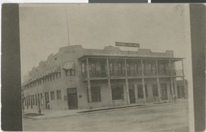
Photograph of the Hotel Nevada (Las Vegas), 1909 or 1910
Date
1909 to 1910
Archival Collection
Description
Early view of the Hotel Nevada on Fremont and Main. Handwritten transcription from original: "1909 or 1910. R. Pearce. Hotel Nev, now Sal Sagev." The Hotel Nevada changed to the Sal Sagev from 1931-1955, then to the Golden Gate Hotel and Casino.
Site Name: Hotel Nevada
Address: 1 Fremont Street
Image
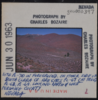
Photographic slide of geological sites in Pershing County, Nevada, circa early 1960s
Date
1960 (year approximate) to 1963 (year approximate)
Archival Collection
Description
Written on the slide: "Site Pe-70 in foreground. On other side of Santa Clara Creek are sites Pe-67 (at tree), Pe-68, Pe-69. Looking north and west. Pershing County Nevada."
Image
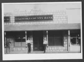
Photograph of O. K. Adcock and David Farnsworth, Caliente, Nevada, 1907
Date
1907
Archival Collection
Description
O. K. Adcock and David Farnsworth in front of The Lincoln County Bank in Caliente, Nevada.
Image
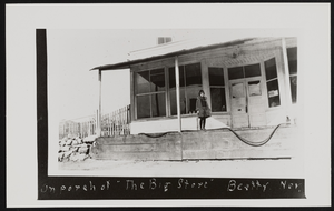
Porch of The Big Store in Beatty, Nevada: photographic print
Date
1928
Archival Collection
Description
Lorraine Perry Thomas on porch of The Big Store in Beatty, Nevada in 1928.
Image

Photograph of Count Rock, Panaca, Nevada, circa 1972
Date
1971 to 1973
Archival Collection
Description
A view of Count Rock, a mountain landscape located near Panaca, Nevada.
Image

Photograph of Count Rock, Panaca, Nevada, circa 1972
Date
1971 to 1973
Archival Collection
Description
A view of Count Rock, a mountain landscape located near Panaca, Nevada.
Image
Pagination
Refine my results
Content Type
Creator or Contributor
Subject
Archival Collection
Digital Project
Resource Type
Year
Material Type
Place
Language
Records Classification
