Search the Special Collections and Archives Portal
Search Results
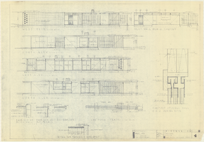
Architectural drawings of a residential home in Las Vegas, Nevada, November 2, 1962
Date
Description
Exterior elevations and details for a residential home on Fifth Place in Las Vegas, Nevada. Sheet no. 4. "Drw. D.H."
Architecture Period: Mid-Century ModernistImage
C. A. Earle Rinker Photograph Collection of Goldfield, Nevada
Identifier
Abstract
The C. A. Earle Rinker Photograph Collection of Goldfield, Nevada (approximately 1900-1915) contains individual black-and-white photographic prints, photographic albums, black-and-white and tinted postcards, and photographic negatives that document the history of early twentieth century Goldfield, Nevada. The images include photographic prints of Goldfield and surrounding areas during its peak years of 1906-1910; postcards showing scenes of Goldfield, Tonopah, and other areas in central Nevada; and negatives that contain images of Rinker's family and homelife in Indiana and Illinois.
Archival Collection
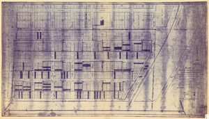
Plat of original townsite of Las Vegas, Clark County, Nevada, November 25, 1927
Date
Description
Subtitle: 'On N 1/2 of SW 1/4 section 27, T 20 S, R 61 E, M.D. Mer. showing cast iron water mains. Including location and distances of valves, fire hydrants, house connections, etc. Constructed by Las Vegas Land &Water Company. Construction completed Nov. 25-1927. Cast iron pipe system throughout made at Provo, Utah by Pacific States Cast Iron Pipe Company. R.N. Clark, Construction Engineer. Map and survey made by J.T. McWilliams, C.E., Las Vegas, Nev.' Map shows ownership of some parcels of land. Scale [ca. 1:960]. 1 inch to 80 feet. Blueline print. Plat map.
Image
UNLV University Libraries Collection on Nevada Mining
Identifier
Abstract
The Nevada Mining Collection is comprised of records that document mining and mines in Nevada from 1842 to 1966. The majority of the collection includes records of various mines and mining companies located in the Esmeralda, Lincoln, Clark, White Pine, and Nye counties, dating from 1900 to 1928. The collection includes financial, administrative, and business related records; photographs of miners, mining camps, and towns; correspondence; maps; newspaper clippings, pamphlets, newsletters, and booklets.
Archival Collection
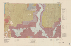
Topographic map of Lake Mead quadrangle, Nevada and Arizona, 1979
Date
Description
universal transverse Mercator proj. (W 115°00'--W 114°00'/N 36°30'--N 36°00'). Series: Surface-minerals management status. United States. Bureau of Land Management. Surface-minerals management status. Filing title: Lake Mead, Nev.--Ariz., 1979. Shows township and range lines. Published by United States, Dept. of the Interior, Bureau of Land Management
Denver, Colo. : For sale by U.S. Geological Survey,
Image
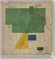
Map of Las Vegas and vicinity, Clark County, Nevada, April 15, 1951
Date
Description
Image
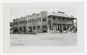
Photograph of Hotel Nevada, Las Vegas (Nev.), 1912
Date
Archival Collection
Description
Image
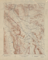
Topographic map of the Furnace Creek quadrangle, Nevada and California, 1947
Date
Description
Text
Dorothy Ray Photograph Collection on Southern Nevada
Identifier
Abstract
The Dorothy Ray Photograph Collection on Southern Nevada, approximately 1900-1946, depicts infrastructure in Caliente, Nevada in the early to mid-twentieth century. The collection also contains images of a flash flood that occurred in 1905 in Carp, Nevada and Stine, Nevada that washed away roads and railroad tracks. This collection provides historical documentation about early to mid-century Caliente, Nevada.
Archival Collection
Nevada Biltmore Hotel Collection
Identifier
Abstract
The collection dates from 1942 to 1986 and contains a scrapbook and other materials related to the Nevada Biltmore built by Robert Brooks in Las Vegas, Nevada. The scrapbook includes photographs of the resort and newspaper clippings. It also contains some materials from the Seven Seas restaurant owned by Brooks in Hollywood, California. The collection includes newspaper clippings related to Las Vegas gaming and politics, some photographs of Bob Brooks and his wife Jewel at social events in Las Vegas, and a Biltmore menu and stationary.
Archival Collection
