Search Results
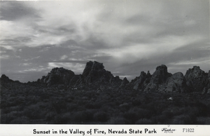
Postcard showing Valley of Fire, Nevada, circa 1930s-1950s
Date
1935 to 1959
Archival Collection
Description
An image of a sunset at the Valley of Fire. Text on bottom of image reads: "Sunset in the Valley of Fire, Nevada State Park."
Image
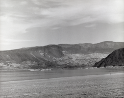
Film transparency of Boulder Beach on Lake Mead, Nevada, 1961
Date
1961
Archival Collection
Description
Boulder Beach on Lake Mead, near Boulder City, Nevada 1961. Three small islands are visible in the foreground.
Image
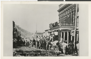
Postcard of pioneer stages on C Street, Virginia City, Nevada, 1866
Date
1866
Archival Collection
Description
A view of pioneer stages leaving Wells Fargo & Co. on C Street in Virginia City, Nevada. Street Address: C Street
Image
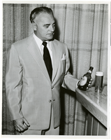
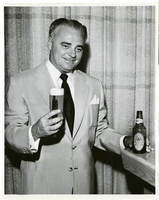
Photograph of Wilbur Clark, Las Vegas, Nevada, circa 1950s
Date
1950 to 1959
Archival Collection
Description
Wilbur Clark at a bar with a bottle of Ballantine's Ale, probably inside the Desert Inn Hotel, Las Vegas, Nevada.
Image
Photograph of Wilbur Clark, Las Vegas, Nevada, circa 1950s
Date
1950 to 1959
Archival Collection
Description
Wilbur Clark at a bar with a glass of Ballantine's Ale, probably inside the Desert Inn Hotel, Las Vegas, Nevada.
Image

Photograph of the Jamboree Parade, Boulder City, Nevada, circa 1964
Date
1964
Archival Collection
Description
Description provided with image: "Shriners entry into the Boulder City, Nevada Jamboree Parade. Albert J. Fischer is pictured in the car."
Image
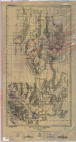
Map of a part of southern Nevada showing ground-water conditions, 1914
Date
1914
Description
At bottom of map: 'Base compiled from plane-table sheets, topographic maps of U.S. Geological Survey, railroad alignments, and General Land Office data.' Relief shown by hachures and spot heights. Shows township and range grid. Covers from southeast corner of White Pine County to Sloan and from Nye County border to Arizona-Utah border. Shows flowing wells, nonflowing wells, springs, flowing-well areas, dry holes and shore lines of ancient lakes. Scale 1:500,000 (W116°--W 114°/N 45°--N 36°). Series: Water-supply paper (Washington, D.C.), 365. Map is plate 1 from the U.S. Geological Survey water-supply paper 365.
Image
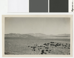
Photograph of Spotted Range, Nevada, before 1950
Date
open start to 1950
Archival Collection
Description
The view looking north toward Spotted Range from the old road west of Indian Spring Ranch.
Image
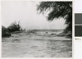
Photograph of flooding in the Nevada desert, circa 1950
Date
1950 (year approximate)
Archival Collection
Description
Flooding in the desert
Transcribed Notes: Transcribed from photo sleeve: "Unidentified location in flood
Image
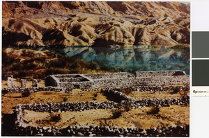
Photograph of Fort Callville, Nevada, before 1935
Date
open start to 1935
Archival Collection
Description
Photo of Fort Callville and corrals.
Image