Search Results
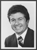
Photograph of Bob Coffin, Las Vegas, Nevada, 1982
Date
1982
Archival Collection
Description
Nevada Assemblyman Bob Coffin.
Image
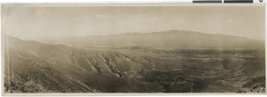
Photograph of Rawhide, Nevada, April 15, 1908
Date
1900 to 1930
Archival Collection
Description
A panorama of Rawhide, Nevada taken from Hooligan Hill. Identified on the image is: Crescent Peak, Silver King Hill, Las Chance Hill, Bluff Hill, Grutt Hill, Balloon Hill, and Murray Hill.
Image
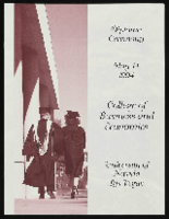
University of Nevada, Las Vegas (UNLV) College of Business and Economics Diploma Ceremony program
Date
1994-05-14
Archival Collection
Description
Commencement program from University of Nevada, Las Vegas Commencement Programs and Graduation Lists (UA-00115).
Text
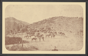
Postcard of mule teams, Belleville, Nevada, 1880s
Date
1880 to 1889
Archival Collection
Description
Mule skinners (drivers) and pack mules loaded with cordwood where it will be transferred to wagons pulled by sixteen-mule (jerk-line) teams and hauled to ore mill at Belleville, Nevada. The ore was to be used for fuel.
Image
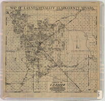
Map of Las Vegas Valley, Clark County, Nevada, October 1, 1940
Date
1940-10-01
Description
'Compiled by C.D. Baker, Civil Engineer, State Water Right Surveyor, Mineral Surveyor, Gen. Land Office, Las Vegas, Clark County, Nevada. Oct. 1, 1940.' Scale [ca. 1:48,000]. 1 in. to 4,000 ft. Cadastral map.
Image
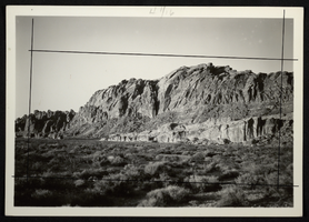
Photograph of Valley of Fire, Nevada, circa 1920s-1955
Date
1920 to 1955
Archival Collection
Description
Picture of Valley of Fire, Nevada.
Image
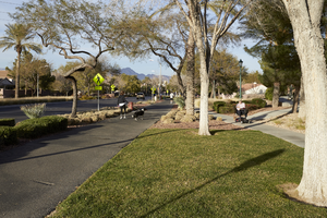
Paseo Verde Drive, Henderson, Nevada: digital photograph
Date
2018-02-03
Archival Collection
Description
Trails are integrated into the design of housing developments along Paseo Verde Parkway near Valle Verde Drive in Henderson, Nevada.
Image
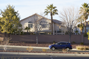
Paseo Verde Drive, Henderson, Nevada: digital photograph
Date
2018-02-03
Archival Collection
Description
A car passes by a single family home along Paseo Verde Parkway near Valle Verde Drive in Henderson, Nevada.
Image
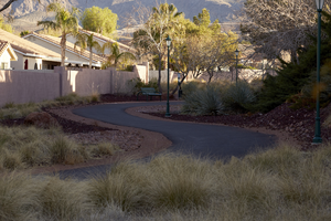
Paseo Verde Drive, Henderson, Nevada: digital photograph
Date
2018-02-03
Archival Collection
Description
Trails and sidewalks are abundant and well used along Paseo Verde Parkway near Valle Verde Drive in Henderson, Nevada.
Image
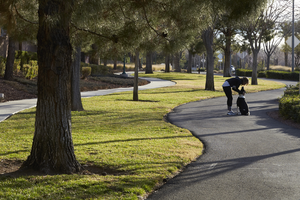
Paseo Verde Drive, Henderson, Nevada: digital photograph
Date
2018-02-03
Archival Collection
Description
Trails and sidewalks are abundant and well used along Paseo Verde Parkway near Valle Verde Drive in Henderson, Nevada.
Image