Search the Special Collections and Archives Portal
Search Results

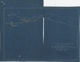
Blueprint map showing proposed new 12" well and pipe line changes at water springs, Las Vegas, Nevada, circa 1920
Date
Archival Collection
Description
Image
University of Nevada, Las Vegas Creative Services Records (1970s)
Identifier
Abstract
This is part 1 of 6 finding aids for the University of Nevada, Las Vegas Creative Services Records and represents 1970 to 1979. Generally, materials are transferred from UNLV Photo Services to UNLV Special Collections and Archives 5 years after they are created. For materials within the last 5 years, email photo@unlv.edu or call 702-895-3036. This finding aid contains the photographic negatives and contact sheets produced by the University of Nevada, Las Vegas from 1970 to 1979 as an official record of the institution's development, activities, and community. Clients include UNLV colleges and departments, the University's administration, the UNLV Foundation, athletic departments, and the Nevada System of Higher Education (NSHE). Images include academic activities, athletic events, faculty and administration, student life, campus life, campus development, architecture, and public relations.
Archival Collection
#69765: UNLV Professor Brendan O'Toole, and an undergraduate intern from Rutgers University join Yong Dawson in helping to take measurements from Dawson's 4-year-old daughter Hailey Dawson in the Science and Engineering building June 19, 2014 at the University of Nevada, Las Vegas, 2014 June 19
Level of Description
Archival Collection
Collection Name: University of Nevada, Las Vegas Creative Services Records (2010s)
Box/Folder: Digital File 00
Archival Component

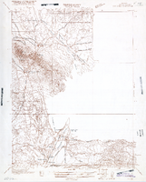
Map of Nevada, Lincoln County, Ely Range Quadrangle, Lincoln County (Nev.), 1921
Date
Description
Image
Equal Rights Nevada Collection
Identifier
Abstract
The Equal Rights Nevada (2000-2002) collection is comprised of organizational records documenting the group’s unsuccessful fight against Question 2, a referendum voted upon in 2000 and 2002 to amend Nevada’s state constitution to forbid same-sex marriage. It includes campaign files, financial records, publicity, correspondence, ephemera, and other supporting documentation from national and regional marriage equality organizations.
Archival Collection
Sam Boyd, owner of Sam's Town Hotel & Gambling Hall, accepts the National Conference of Christians and Jews Citizen of the Year Award; U.S. Senator Howard Cannon presents the award, 1982 January
Level of Description
Archival Collection
Collection Name: Las Vegas Sun Photographs
Box/Folder: Folder 04
Archival Component

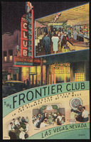
The Frontier Club in Las Vegas, Nevada: postcard
Date
Archival Collection
Description
Image

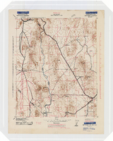
Topographic map of the Camp Mohave quadrangle in California, Nevada and Arizona, 1942
Date
Description
Image
University of Nevada, Las Vegas Creative Services Records (1990s)
Identifier
Abstract
This is part 3 of 6 finding aids for the University of Nevada, Las Vegas Creative Services Records and represents 1990 to 1999. Generally, materials are transferred from UNLV Photo Services to UNLV Special Collections and Archives 5 years after they are created. For materials within the last 5 years, contact photo@unlv.edu or call 702-895-3036. This finding aid contains the photographic negatives, contact sheets, and digital files produced by the University of Nevada, Las Vegas from 1990 to 1999 as an official record of the institution's development, activities, and community. Clients include UNLV colleges and departments, the University's administration, the UNLV Foundation, athletic departments, and the Nevada System of Higher Education (NSHE). Images include academic activities, athletic events, faculty and administration, student life, campus life, campus development, architecture, and public relations.
Archival Collection

The Nevada Club in Reno, Nevada: postcard
Date
Archival Collection
Description
Image
