Search the Special Collections and Archives Portal
Search Results
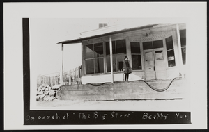
Porch of The Big Store in Beatty, Nevada: photographic print
Date
1928
Archival Collection
Description
Lorraine Perry Thomas on porch of The Big Store in Beatty, Nevada in 1928.
Image

Photograph of Count Rock, Panaca, Nevada, circa 1972
Date
1971 to 1973
Archival Collection
Description
A view of Count Rock, a mountain landscape located near Panaca, Nevada.
Image

Photograph of Count Rock, Panaca, Nevada, circa 1972
Date
1971 to 1973
Archival Collection
Description
A view of Count Rock, a mountain landscape located near Panaca, Nevada.
Image
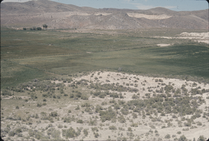
Slide of Meadow Valley, Nevada, circa 1960s - 1970s
Date
1960 to 1979
Archival Collection
Description
Meadow Valley in Nevada. A view of Big Spring can be seen in the distance.
Image
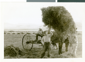
Photograph of Corn Creek Ranch, Nevada, circa 1938
Date
1937 to 1939
Archival Collection
Description
A view of two unidentified men haying on Corn Creek Ranch in Nevada.
Image
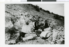
Photograph of men in Arden District, Nevada, 1907-1930
Date
1907 to 1930
Archival Collection
Description
Men in gypsum rock formation, Spring Mountains, Arden District, Nevada.
Image

Photograph of University of Nevada, Las Vegas, circa 1980s
Date
1980 to 1989
Archival Collection
Description
An aerial view of the University of Nevada, Las Vegas (UNLV) campus, looking south.
Image

Photograph of Camp Butler, Tonopah, Nevada, January 1901
Date
1901-01
Archival Collection
Description
A small mining camp established by Jim Butler near the mountains in Tonopah, Nevada.
Image
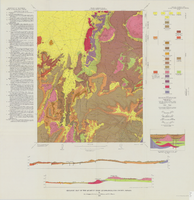
Geologic map of the Quartet Dome quadrangle, Nye County, Nevada, 1966
Date
1966
Description
58 x 46 cm., on sheet 88 x 85 cm., folded in envelope 30 x 24 cm. Relief shown by contours and spot heights. "Contour interval 20 feet." "Base by U.S. Geological Survey, 1962, 10,000-foot grid based on Nevada coordinate system, central zone." "Geology mapped in 1962-63." Includes 2 col. cross sections, diagrammetric stratigraphic section, quadrangle location map, and text. "Prepared in cooperation with the U.S. Atomic Energy Commission." Original publisher: Interior, Geological Survey, Series: Geologic quadrangle map GQ, Scale: 1:24 000.
Image
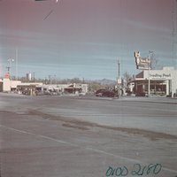
Film transparency of Boulder City, Nevada, circa 1931-circa 1940s
Date
1931 (year uncertain; year approximate) to Unknown year in the decade of the 1940s
Archival Collection
Description
An image of Arizona Street (pointing northeast) in Boulder City. From this view point, may different city shops are visible, such as a Shell gas station, the Visitors Bureau, and the Nava-Hopi Trading Post, as well as a sign directing visitors to the nearby Hoover Dam. The Hoover Dam Visitors Bureau was originally known as the Boulder Dam Tourist Service Bureau, as the dam's name officially changed in 1947.
Image
Pagination
Refine my results
Content Type
Creator or Contributor
Subject
Archival Collection
Digital Project
Resource Type
Year
Material Type
Place
Language
Records Classification
