Search the Special Collections and Archives Portal

Search Results
Display    Results Per Page
Displaying results 5381 - 5390 of 576391

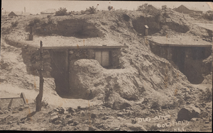
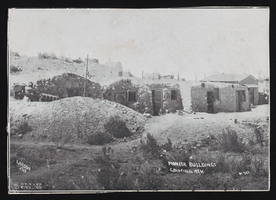
Pioneer buildings, Goldfield, Nevada: postcard

Date

1900 to 1909

Description

From the Frank Benham Photograph Collection on Goldfield, Nevada (PH-00288).

Image

Dugout homes, Goldfield, Nevada: postcard

Date

1900 to 1909

Description

From the Frank Benham Photograph Collection on Goldfield, Nevada (PH-00288).

Image

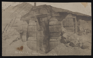
Barrell House, Tonopah, Nevada: postcard

Date

1900 to 1909

Description

From the Frank Benham Photograph Collection on Goldfield, Nevada (PH-00288).

Image

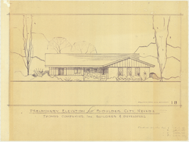
Architectural drawing of residential home in Boulder City, Nevada, preliminary elevation, 1962

Date

1962

Description

Preliminary drawing of front exterior elevation of ra anch-style residential home in Boulder City, Nevada. Handwritten near lower right: "Elevations only for Plan 1 (1B, 1C, 1D), Plan 2 (2B, 2C, 2D), Plan 4 (4B, 4C, 4D), Plan 5 (5B, 5C, 5D)."

Architecture Period: Mid-Century Modernist

Image

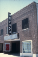
Slide of the Nevada Theater, Wells, Nevada, 1986

Date

1986

Description

An image of the Nevada Theater located in Wells. The black and white neon sign located above the entrance doors to the building reads: "Nevada." Site Name: Nevada Theater (Wells, Nev.)

Image

Aid for AIDS of Nevada fan

Date

1990 (year approximate) to 1999 (year approximate)

Description

From the Dennis McBride Collection on LGBTQ Las Vegas, Nevada (MS-00802) -- Alphabetical research files -- AIDS: Organizations: Aid for AIDS of Nevada (AFAN) file.

Text

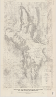
Map of the Las Vegas ground-water basin, Clark, Nye, and Lincoln Counties, Nevada, 1965

Date

1965

Description

At top of map: 'United States Department of the Interior, Geological Survey. Water-supply paper 1780, plate 1.' At bottom of map: 'Base from Army Map Service sheets NJ 11-9, NJ 11-12, and NI 11-3 (1947).' 'Boundary between bedrock and alluvium in Clark County, Nev., compiled by Ben Boyer, E. H. Pampeyan and C. R. Longwell. In Lincoln and Nye Counties, contact determined from aerial photographs.' 'Interior--Geological Survey, Washington, D.C.--1965--W63358.' Includes township and range lines.Relief shown by contours. Thematic map. Scale 1:250,000 (W 116°--W 114°45´/N 37°00´--N 35°30´). Series: Water-supply paper (Washington, D.C.), 1780. Originally published as plate 1 of Available water supply of the Las Vegas ground-water basin, Nevada, by Glenn T. Malmberg, published by the Geological Survey in 1965 as its Water-supply paper 1780.

Image

Tonopah, Nevada Mining Town Photograph Album

Identifier

PH-00411

Abstract

The Tonopah, Nevada Mining Town Photograph Album (approximately 1908) consists of twenty-two photographs in a leather-bound album. The photographs depict businesses, townspeople, street scenes, and mining operations in Tonopah, Nevada and the surrounding areas of Goldfield, Nevada and Mina, Nevada. Also included are photographs of a fire on May 12, 1908 that destroyed a block of commercial buildings in Tonopah, which were taken by local photographer E. W. Smith., and views of the downtown area both before and after the fire.

Archival Collection
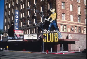
Slide of Nevada Club, Ely, Nevada, 1986

Date

1986

Description

An image of the exterior of the Nevada Club and Hotel Nevada in Ely. Mounted onto the brick building and hanging over the club's entrance is a large sign of a miner with a pickaxe. Various neon signs read: "Welcome, 21 Slots & Food, Dancing;" "Hotel Nevada;" "Free Parking;" and "Nevada Club."

Image

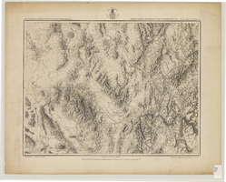
Map showing parts of eastern and southeastern Nevada and southwestern Utah, circa 1873

Date

1869
1872 to 1873

Description

Scale 1:506,880. 1 in. to 8 miles (W 117°30--W 114°45/N 37°20--N 40°00). Relief shown by hachures and spot heights. At top left: 'Explorations & surveys west of the one-hundredth meridian.' At top right: 'Parts of Eastern & Southeastern Nevada & Southwestern Utah. Atlas sheet number 66.' At bottom left: 'Expeditions of 1869, 1872 & 1873.' At bottom right: ' 1st Lieut. Geo. M. Wheeler, Corps of Engineers, com'd'g.' Seal of the War Department, Corps of Engineers, U.S. Army at top center of map. Originally published as part of the geological atlas which is an appendix to the Survey's Report upon United States geographical surveys west of the one hundredth meridian, published in 1876?

Image