Search the Special Collections and Archives Portal
Search Results
Donald Cowper Henderson, May Stephen Henderson Murray, Nancy Henderson, Margaret Henderson Martin, and their mother Mary, San Bernardino, California, approximately 1900-1905
Level of Description
Archival Collection
Collection Name: Fayle Family Photographs
Box/Folder: Folder 01
Archival Component
Portrait of P.T. Barnum performer Admiral Dot (born Leopold S. Kahn) with his wife Lottie Naomi Swartwood and their children: photographic print, approximately 1900 to 1915
Level of Description
Archival Collection
Collection Name: Leon Rockwell Photograph Collection
Box/Folder: Folder 18
Archival Component

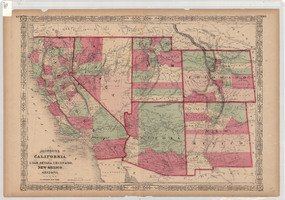
Map of California, and territories of Utah, Nevada, Colorado, New Mexico and Arizona, 1864
Date
Description
Text
Frank Benham Photograph Collection on Goldfield, Nevada
Identifier
Abstract
The Frank Benham Photograph Collection on Goldfield, Nevada (1900s-1947) primarily contains black-and-white photographic prints of buildings and people in Goldfield, Nevada. Also included in the collection are black-and-white photographic prints of nearby mining towns, as well as postcards and one negative. Frank Benham co-owned a real estate business and served as assistant postmaster for Goldfield in the early 1900s.
Archival Collection

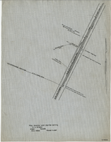
Map showing water pipeline serving H. C. Wheeler, Arden, Nevada, November 1929
Date
Archival Collection
Description
Image

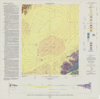
Geologic map of the Frenchman Flat quadrangle, Nye, Lincoln, and Clark Counties, Nevada, 1965
Date
Description
Image
Photographic print, annotated: "Arrival of Tex Rickards' drill for mining and water, Rawhide Northern Water Company." Handwritten note on back: photographic print, approximately 1900-1915
Level of Description
Archival Collection
Collection Name: C. A. Earle Rinker Photograph Collection of Goldfield, Nevada
Box/Folder: Folder 06
Archival Component
George Lockhart in his office. His right hand is wrapped in gauze. The inscription on the back of the photo reads: "George Lockhart, son of Thomas Lockhart, owner of Florence Mine, Goldfield, Nevada. In office where I worked for Davis & Shoemaker": photographic print, approximately 1900-1915
Level of Description
Archival Collection
Collection Name: C. A. Earle Rinker Photograph Collection of Goldfield, Nevada
Box/Folder: Folder 02
Archival Component

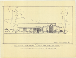
Architectural drawing of residential home in Boulder City, Nevada, preliminary elevation, 1962
Date
Archival Collection
Description
Preliminary drawing of front exterior elevation of ranch-style residential home in Boulder City, Nevada.
Architecture Period: Mid-Century ModernistImage
