Search Results
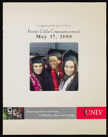
University of Nevada, Las Vegas (UNLV) 45th commencement program
Date
Archival Collection
Description
Commencement program from University of Nevada, Las Vegas Commencement Programs and Graduation Lists (UA-00115).
Text
University of Nevada, Las Vegas (UNLV) Fall 2020 commencement program
Date
Archival Collection
Description
Commencement program from University of Nevada, Las Vegas Commencement Programs and Graduation Lists (UA-00115).
Text
University of Nevada, Las Vegas (UNLV) 11th commencement program
Date
Archival Collection
Description
Commencement program from University of Nevada, Las Vegas Commencement Programs and Graduation Lists (UA-00115).
Text
Beatty, Nevada, 1904-1989
Level of Description
Scope and Contents
Materials contain photographs of families and ranches around Beatty, Nevada from 1904 to 1989. Materials include photographs of the Brockman, Lisle, Revert, Crowell, Lemmon, Palsgrove, and Reidhead families, documenting activities such as events on Main Street, construction of several buildings, protests against the Nevada Test Site, animal husbandry, railroad transportation (especially by the Tonopah and Tidewater Railroad), education, and mining and milling.
Archival Collection
Archival Component
Lovelock, Nevada, 1930 to 1986
Level of Description
Scope and Contents
Materials contain photographic slides of neon signs for hotels and casinos in Lovelock, Nevada from 1930 to 1986.
Archival Collection
Archival Component
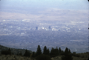
Slide of Reno, Nevada, circa 1970s
Date
Archival Collection
Description
Image
Nevada Governors, 1861-1975
Level of Description
Scope and Contents
Materials include photographs of the governors of Nevada from 1861 to 1975.
Archival Collection
Archival Component

Topographic map of groundwater in the southeast quadrangle of Las Vegas, Nevada, 1980
Date
Description
Text
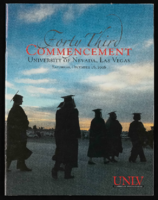
University of Nevada, Las Vegas (UNLV) 43rd commencement program
Date
Archival Collection
Description
Commencement program from University of Nevada, Las Vegas Commencement Programs and Graduation Lists (UA-00115).
Text
Houghton, J. G., C. M. Sakamoto, and R. O. Gifford, 1975, Nevada's Weather and Climate, Special Publication No. 2, Nevada Bureau of Mines and Geology and MacKay School of Mines, University of Nevada-Reno, Reno, Nevada, 1975
Level of Description
Archival Collection
Archival Component