Search the Special Collections and Archives Portal
Search Results
Tonopah, Nevada Mining Town Photograph Album
Identifier
Abstract
The Tonopah, Nevada Mining Town Photograph Album (approximately 1908) consists of twenty-two photographs in a leather-bound album. The photographs depict businesses, townspeople, street scenes, and mining operations in Tonopah, Nevada and the surrounding areas of Goldfield, Nevada and Mina, Nevada. Also included are photographs of a fire on May 12, 1908 that destroyed a block of commercial buildings in Tonopah, which were taken by local photographer E. W. Smith., and views of the downtown area both before and after the fire.
Archival Collection
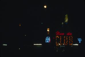
Slide of neon signs for Nevada Club, Ely, Nevada, 1986
Date
Archival Collection
Description
Image
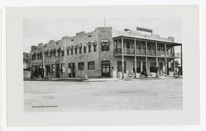
Photograph of Hotel Nevada, Las Vegas (Nev.), 1912
Date
Archival Collection
Description
Image
Archaeo-Nevada Society Records
Identifier
Abstract
The Archaeo-Nevada Society Records (1930-2016) consist of archaeological and conservation articles, correspondence, brochures, newsletters, programs, maps, and information about the flora and fauna of Nevada. Materials also include scrapbooks and photograph albums detailing the activities of the society between 1966 and 1999.
Archival Collection
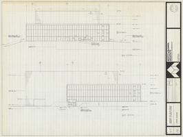
Architectural drawing of Performing Arts Center, Phase II, University of Nevada, Las Vegas, exterior elevations, July 31, 1974
Date
Archival Collection
Description
East and south exterior elevations of Performing Arts Center (later to become the Judy Bayley Theatre), University of Nevada, Las Vegas. Scale: 1/8" = 1'-0". "Drawn by J.A.L. Checked by O.D.S. Job no. 720. Date 7-31-74." "Sheet A-7 of 28."
Site Name: University of Nevada, Las Vegas
Address: 4505 S. Maryland Parkway
Image
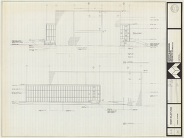
Architectural drawing of Performing Arts Center, Phase II, University of Nevada, Las Vegas, exterior elevations, July 31, 1974
Date
Archival Collection
Description
West and north exterior elevations of Performing Arts Center (later to become the Judy Bayley Theatre), University of Nevada, Las Vegas. Scale: 1/8" = 1'-0". "Sheet A-8 of 28." "Drawn by J.A.L. Checked by O.D.S. Job no. 720. Date 7-31-74."
Site Name: University of Nevada, Las Vegas
Address: 4505 S. Maryland Parkway
Image
Nevada Southern Campus Fund Collection
Identifier
Abstract
The Nevada Southern Campus Fund Collection (1955) consists of the Nevada Southern University Book of Donors. This oversized scrapbook contains the names of local businesses, politicians, and Las Vegans who donated over $50 to the Nevada Southern Campus Fund in 1955. Nevada Southern University later became the University of Nevada, Las Vegas (UNLV). Some names include Elks Lodge, Rotary Club of Las Vegas, and Junior League of Las Vegas.
Archival Collection
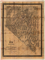
Map of the state of Nevada, 1886
Date
Description
Image
