Search the Special Collections and Archives Portal
Search Results
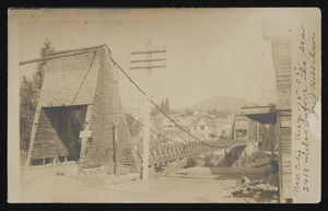
View of a bridge located in Nevada City, Nevada: postcard
Date
1905-08-15
Archival Collection
Description
From the UNLV Libraries Single Item Accession Photograph Collection (PH-00171)
Image
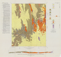
Geologic map of the Plutonium Valley quadrangle, Nye and Lincoln counties, Nevada, 1965
Date
1965
Description
58 x 46 cm., on sheet 77 x 83 cm., folded in envelope 30 x 24 cm. Relief shown by contours and spot heights. "Geology mapped in 1961." Includes description of map units, col. cross section, and quadrangle location map. "Prepared in cooperation with the U. S. Atomic Commission." Original publisher: Interior, Geological Survey, Series: Geologic quadrangle map GQ, Scale: 1:24 000.
Image
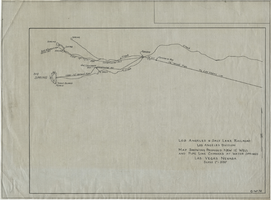
Map showing proposed new 12" well and pipe line changes at Water Springs, Las Vegas, Nevada, circa 1920
Date
1916 to 1925
Archival Collection
Description
In lower right corner: '6-W-74.' Scale: 1" = 500'.
Image
Album 6: scenes in Southern Nevada, including the Kiel Ranch, Rhyolite, Nevada, and Thomas, Nevada: photographic prints
Date
1900 (year approximate) to 1939 (year approximate)
Archival Collection
Description
From the Maurine and Fred Wilson and Dr. William S. Park Photograph Albums (PH-00222) -- Album 6
Image
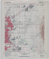
Topographic map of the northeast quadrangle of the metropolitan Las Vegas, Nevada area, 1967
Date
1967
Description
Scale 1:24,000 ; polyconic proj. (W 115°730--W 115°0000/N 36°1500--N 36°730) ; 1 map : col. ; 58 x 47 cm ; 7.5 minute series (topographic) ; Relief shown by contours and spot heights ; Filing title: Las Vegas NE, Nev ; "AMS 2956 II NE--Series V896." ; Contour interval 20 feet ; "Topography by photogrammetric methods from aerial photographs taken 1965. Field checked 1967." ;Includes quadrangle location map ; Interior--Geological Survey
Image
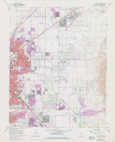
Topographic map of the northeast quadrangle of the metropolitan Las Vegas, Nevada area, 1973
Date
1973
Description
Scale 1:24,000 ; polyconic proj. (W 115°730--W 115°0000/N 36°1500--N 36°730) ; 1 map : col. ; 58 x 47 cm ; 7.5 minute series (topographic) ; Relief shown by contours and spot heights ; "AMS 2956 II NE--Series V896." ; Contour interval 20 feet ; "Topography by photogrammetric methods from aerial photographs taken 1965. Field checked 1967." ; "Revisions shown in purple compiled from aerial photographs taken 1973. This information not field checked." ; Includes quadrangle location map ; Filing title: Las Vegas, NE, Nev ; Interior--Geological Survey
Image
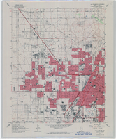
Topographic map of the northwest quadrangle of the metropolitan Las Vegas, Nevada area, 1967
Date
1967
Description
Scale 1:24,000 ; polyconic proj. (W 115°1500--W 115°730/N 36°1500--N 36°730) ; 1 map : col. ; 58 x 47 cm ; 7.5 minute series (topographic) ; Relief shown by contours and spot heights ; Filing title: Las Vegas NW, Nev ; "AMS 2956 II NW--Series V896." ; Contour interval 10 feet ; "Topography by photogrammetric methods from aerial photographs taken 1965. Field checked 1967." ; Includes quadrangle location map ; Interior--Geological Survey
Image
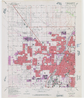
Topographic map of the northwest quadrangle of the metropolitan Las Vegas, Nevada area, 1973
Date
1973
Description
Scale 1:24,000 ; polyconic proj. (W 115°1500--W 115°730/N 36°1500--N 36°730) ; 1 map : col. ; 58 x 47 cm ; 7.5 minute series (topographic) ; Relief shown by contours and spot heights ; Filing title: Las Vegas NM, Nev ; "AMS 2956 II NW--Series V896." ; Contour interval 10 feet ; "Topography by photogrammetric methods from aerial photographs taken 1965. Field checked 1967." ; "Revisions shown in purple compiled from aerial photographs taken 1973. This information not field checked." ; Includes quadrangle location map ; Interior--Geological Survey
Image
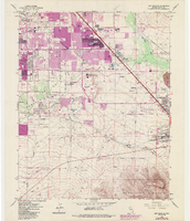
Topographic map of the southeast quadrangle of the metropolitan Las Vegas, Nevada area, 1984
Date
1984
Description
Scale 1:24,000 ; polyconic proj. (W 115°0730--W 115°0000/N 36°0730--N 36°0000) ; 1 map : col. ; 58 x 47 cm ; 7.5 minute series (topographic) ; Relief shown by contours and spot heights ; Filing title: Las Vegas SE, Nev ; "DMA 2956 II SE--Series V896." ; Contour interval 20 feet ; "Topography by photogrammetric methods from aerial photographs taken 1965. Field checked 1967." ; "Revisions shown in purple and woodland compiled from aerial photographs taken 1982 and other sources. This information not field checked. Map edited 1984." ; Includes quadrangle location map ; Interior--Geological Survey
Image
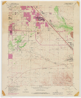
Topographic map of the southeast quadrangle of the metropolitan Las Vegas, Nevada area, 1973
Date
1973
Description
Scale 1:24,000 ; polyconic proj. (W 115°0730--W 115°0000/N 36°0730--N 36°0000) ; 1 map : col. ; 58 x 47 cm ; 7.5 minute series (topographic) ; Relief shown by contours and spot heights ; Filing title: Las Vegas SE, Nev ; "AMS 2956 II SE--Series V896." ; Contour interval 20 feet ; "Topography by photogrammetric methods from aerial photographs taken 1965. Field checked 1967." ; "Revisions shown in purple compiled from aerial photographs taken 1973. This information not field checked." ; Includes quadrangle location map ; Interior--Geological Survey
Image
Pagination
Refine my results
Content Type
Creator or Contributor
Subject
Archival Collection
Digital Project
Resource Type
Year
Material Type
Place
Language
Records Classification
