Search the Special Collections and Archives Portal
Search Results
Manhattan, Nevada, undated
Level of Description
File
Archival Collection
Nye County, Nevada Photograph Collection
To request this item in person:
Collection Number: PH-00221
Collection Name: Nye County, Nevada Photograph Collection
Box/Folder: Folder 45
Collection Name: Nye County, Nevada Photograph Collection
Box/Folder: Folder 45
Archival Component
Nevada exhibits, 1957
Level of Description
File
Archival Collection
Colorado River Commission of Nevada Reference Library Collection
To request this item in person:
Collection Number: MS-00427
Collection Name: Colorado River Commission of Nevada Reference Library Collection
Box/Folder: Box 01
Collection Name: Colorado River Commission of Nevada Reference Library Collection
Box/Folder: Box 01
Archival Component
Rawhide, Nevada, 1908
Level of Description
File
Archival Collection
Central Nevada Historical Society Photograph Collection
To request this item in person:
Collection Number: PH-00082
Collection Name: Central Nevada Historical Society Photograph Collection
Box/Folder: Folder 01
Collection Name: Central Nevada Historical Society Photograph Collection
Box/Folder: Folder 01
Archival Component
Berlin, Nevada, 1905
Level of Description
File
Archival Collection
Central Nevada Historical Society Photograph Collection
To request this item in person:
Collection Number: PH-00082
Collection Name: Central Nevada Historical Society Photograph Collection
Box/Folder: Folder 01
Collection Name: Central Nevada Historical Society Photograph Collection
Box/Folder: Folder 01
Archival Component
Blair, Nevada, 1907
Level of Description
File
Archival Collection
Central Nevada Historical Society Photograph Collection
To request this item in person:
Collection Number: PH-00082
Collection Name: Central Nevada Historical Society Photograph Collection
Box/Folder: Folder 02
Collection Name: Central Nevada Historical Society Photograph Collection
Box/Folder: Folder 02
Archival Component
Wahmonie, Nevada, 1928
Level of Description
File
Archival Collection
Central Nevada Historical Society Photograph Collection
To request this item in person:
Collection Number: PH-00082
Collection Name: Central Nevada Historical Society Photograph Collection
Box/Folder: Folder 02
Collection Name: Central Nevada Historical Society Photograph Collection
Box/Folder: Folder 02
Archival Component
Diamondfield, Nevada, 1904
Level of Description
File
Archival Collection
Central Nevada Historical Society Photograph Collection
To request this item in person:
Collection Number: PH-00082
Collection Name: Central Nevada Historical Society Photograph Collection
Box/Folder: Folder 02
Collection Name: Central Nevada Historical Society Photograph Collection
Box/Folder: Folder 02
Archival Component

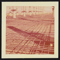
Construction of Nevada Southern University (University of Nevada, Las Vegas), image 001: photographic print
Date
1958
Archival Collection
Description
Construction of Nevada Southern University (UNLV).
Image

Construction of Nevada Southern University (University of Nevada, Las Vegas), image 002: photographic print
Date
1958
Archival Collection
Description
Construction of Nevada Southern University (UNLV).
Image

Construction of Nevada Southern University (University of Nevada, Las Vegas), image 003: photographic print
Date
1958
Archival Collection
Description
Construction of Nevada Southern University (UNLV).
Image
Pagination
Refine my results
Content Type
Creator or Contributor
Subject
Archival Collection
Digital Project
Resource Type
Year
Material Type
Place
Language
Records Classification
