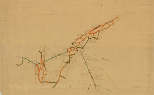
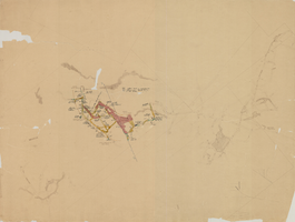
Search Results

Map of the 328 foot level of the Combination Mine, Goldfield, Nevada, circa 1902-1908
Date
1902 to 1908
Description
Hand-drawn, hand-colored and annotated map showing the 328 foot level of the Combination Mine.
Image
Map of the 130 foot level of the Combination Mine, Goldfield, Nevada, circa 1902-1908
Date
1902 to 1908
Description
'130 ft. level. Combination Mine.' 'Scale 1 in.=40 ft.' Hand-drawn, hand-colored and annotated map showing the 130 foot level of the Combination Mine.
Image
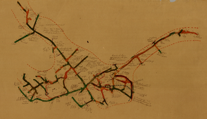
Map of the 330 foot level of the Combination Mine, Goldfield, Nevada, circa 1902-1908
Date
1902 to 1908
Description
Hand-drawn, hand-colored and annotated map showing the 330 foot level of the Combination Mine.
Image
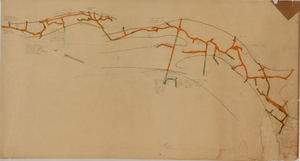
Map of the 380 foot level of the Locke Mine, Goldfield, Nevada, circa 1902-1908
Date
1902 to 1908
Description
'380 ft. level.' Hand-drawn, hand-colored and annotated map showing the 380 foot level of the Locke Mine.
Image
Map of the fourth level of the Red Top Mine, Goldfield, Nevada, circa 1902-1908
Date
1902 to 1908
Description
'Red Top, 4th level. 5586.90.' Hand-drawn, hand-colored and annotated map showing the fourth level of the Rep Top Mine.
Image
Map of the first level of the Red Top Mine, Goldfield, Nevada, circa 1902-1908
Date
1902 to 1908
Description
'Red Top, 1st level. 5820.30.' Hand-drawn, hand-colored and annotated map showing the first level of the Red Top Mine.
Image
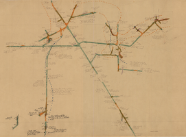
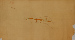
Map of the 450 foot level of the Mohawk Mine, Goldfield, Nevada, circa 1902-1908
Date
1902 to 1908
Description
'(3rd) 450 Ft. level Mohawk.' Hand-drawn, hand-colored and annotated map showing the 450 foot, or third, level of the Mohawk Mine.
Image
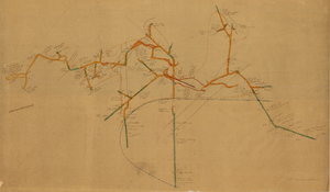
Map of the 280 foot level of the Combination Mine, Goldfield, Nevada, circa 1902-1908
Date
1902 to 1908
Description
Hand-drawn, hand-colored and annotated map showing the 280 foot level of the Combination Mine. Printed on map: 'Mohawk, col. el. 5958.48; Hayes & Monnette No. 2, col. el. 5935.7; Hayes & Monnette No. 1, col. el. 5925.8; Truett, col. el. 5938.8; Combination, col. el. 5986.31.'
Image
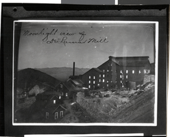
Photograph of Delamar Mill, Nevada, circa late 1800s
Date
1890 to 1899
Archival Collection
Description
Black and white image of Delamar Mill. Transcribed from image: "Moonlight view of Delamar Mill."
Image

Photograph of open pit mine, Ruth, Nevada, 1934
Date
1934
Archival Collection
Description
Open pit mine.
Image