Search Results
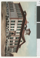
Postcard of Carson City Public School, Carson City (Nev.),1900-1930
Date
Archival Collection
Description
Image
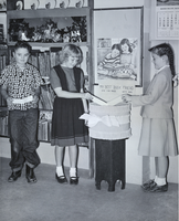
Photograph of children at the Boulder City Library, Boulder City, Nevada, November 1949
Date
Archival Collection
Description
Image

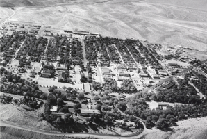
Photograph of Boulder City, Nevada, 1949
Date
Archival Collection
Description
Image
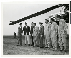
Photograph of Howard Hughes with a group of men in front of the XH-17 helicopter, Culver City, California, October 23, 1952
Date
Archival Collection
Description
Image
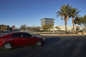
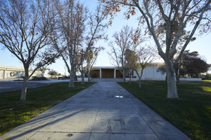
North Las Vegas City Hall building with car on Civic Center Drive, looking west in North Las Vegas, Nevada: digital photograph
Date
Archival Collection
Description
From the UNLV University Libraries Photographs of the Development of the Las Vegas Valley, Nevada (PH-00394). Part of the collection documents the entire 19 mile length of the north/south Eastern Avenue / Civic Center Drive alignment. This photograph was captured in the section of Civic Center Drive between Las Vegas Boulevard and Lake Mead Boulevard.
Image
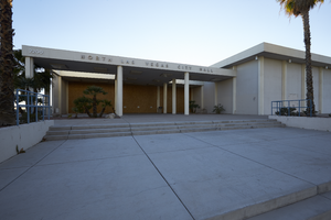
Exterior view of the former North Las Vegas City Hall building on Civic Center Drive in North Las Vegas, Nevada: digital photograph
Date
Archival Collection
Description
From the UNLV University Libraries Photographs of the Development of the Las Vegas Valley, Nevada (PH-00394). Part of the collection documents the entire 19 mile length of the north/south Eastern Avenue / Civic Center Drive alignment. This photograph was captured in the section of Civic Center Drive between Las Vegas Boulevard and Lake Mead Boulevard.
Image
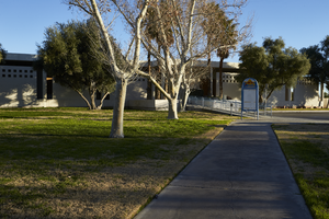
Exterior view of the former North Las Vegas City Hall building on Civic Center Drive in North Las Vegas, Nevada: digital photograph
Date
Archival Collection
Description
From the UNLV University Libraries Photographs of the Development of the Las Vegas Valley, Nevada (PH-00394). Part of the collection documents the entire 19 mile length of the north/south Eastern Avenue / Civic Center Drive alignment. This photograph was captured in the section of Civic Center Drive between Las Vegas Boulevard and Lake Mead Boulevard.
Image
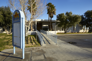
Signage in front of the former North Las Vegas City Hall building on Civic Center Drive in North Las Vegas, Nevada: digital photograph
Date
Archival Collection
Description
From the UNLV University Libraries Photographs of the Development of the Las Vegas Valley, Nevada (PH-00394). Part of the collection documents the entire 19 mile length of the north/south Eastern Avenue / Civic Center Drive alignment. This photograph was captured in the section of Civic Center Drive between Las Vegas Boulevard and Lake Mead Boulevard.
Image
Photograph of Boulder City, Nevada, 1949
Date
Archival Collection
Description
Image