Search Results

Film transparency of Boulder City, Nevada, circa 1931-1936
Date
1931 to 1936
Archival Collection
Description
An image showing an aerial view of Boulder City. The outlines of the small city are distinctively marked by the stark contrast between the city's greenery and the surrounding desert. Note: Bits of the airplane from which the image itself was taken can be seen in the upper right corner of the photograph.
Image
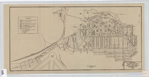
Cadastral map of Boulder City, Nevada, 1940
Date
1905-04-23
Description
A. M. S. Jan. 1940 in the lower left-hand corner. 1 map ; 61 x 30 cm. Cadastral map. "No. 40-1" in the lower right-hand corner. Shows block and lot numbers, buildings, water supply and sewage system, leased areas.
Image
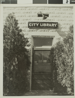
Photograph of Las Vegas City Library, 1943
Date
1943
Archival Collection
Description
The exterior of the Las Vegas City Library in Nevada.
Image
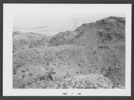
Photograph of Boulder City, Nevada, December 1964
Date
1964-12
Archival Collection
Description
Black and white photograph of mountains in Boulder City.
Image
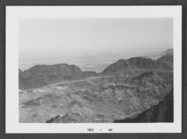
Photograph of Boulder City, Nevada, December 1964
Date
1964-12
Archival Collection
Description
Black and white photograph of mountains in Boulder City.
Image
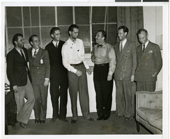
Photograph of Howard Hughes and other men, New York, July 14, 1938
Date
1938-07-14
Archival Collection
Description
Description printed on back of photograph: "At Grover Whalen's home, 48 Washington Mews [sic]. From left to right: L. Thomas Thurlow, Comm. Hl Flannigan, Edward Lund, Howard Hughes, Grover Whalen, R. Stoddart, and Harry Connor. 6/38."
Image
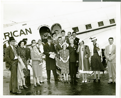
Members of the Howard Hughes around-the-world flight: Thomas Thurlow, navigator; Richard Stoddart, radio engineer; Ed Lund, mechanic; and H. P. Connor, co-navigator, as they rode in the welcoming parade in New York City, 1938 July 15
Level of Description
File
Archival Collection
Howard Hughes Public Relations Photograph Collection
To request this item in person:
Collection Number: PH-00373
Collection Name: Howard Hughes Public Relations Photograph Collection
Box/Folder: Folder 10
Collection Name: Howard Hughes Public Relations Photograph Collection
Box/Folder: Folder 10
Archival Component

Map of California and territories of New Mexico and Utah, circa 1861
Date
1856 to 1866
Description
40 x 60 cm. Relief shown by hachures and spot heights. Prime meridians: Greenwich and Washington. Atlas plate numbers 54 and 55 in the upper corners. Shows forts, trails, exploration routes, drainage, mail steamship routes, physical features, Indian tribes, and historic sites. The geographic region of Southwest is referred to as the New Southwest. Original publisher: Johnson .
Image
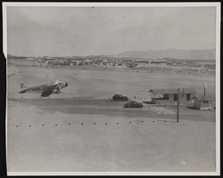
Photograph of an airport, Boulder City (Nev.), March 30, 1937
Date
1937-03-30
Archival Collection
Description
A photograph taken by Rupert B. Spearman of the hub of the Boulder City Airport as seen from the roof of the Grand Canyon Airlines hanger on March 30, 1937. Site Name: Boulder City Municipal Airport (Boulder City, Nev.)
Image
Photograph of Howard Hughes and others at Newark Airport, New Jersey, July 21, 1938
Date
1938-07-21
Archival Collection
Description
Typed onto a piece of paper attached to the image: "Howard Hughes in center leaves Newark Airport with party enroute to Washington, D.C. 7/21/38."
Image