Search Results
Crowd standing outside City Hall while Howard Hughes and his crew get their picture taken in celebration of Hughes's completion of his around-the-world flight in New York City, 1938 July 15
Level of Description
File
Archival Collection
Howard Hughes Public Relations Photograph Collection
To request this item in person:
Collection Number: PH-00373
Collection Name: Howard Hughes Public Relations Photograph Collection
Box/Folder: Folder 12
Collection Name: Howard Hughes Public Relations Photograph Collection
Box/Folder: Folder 12
Archival Component
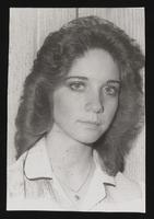
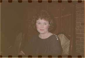
Susan Hall: photographic print
Date
1979 (year approximate) to 1982 (year approximate)
Archival Collection
Description
Susan Hall, daughter of Kathy Ledford Hall.
Image
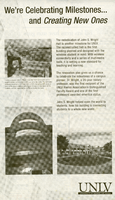
John S. Wright Hall rededication: newspaper clipping
Date
2005 (year approximate)
Archival Collection
Description
Undated UNLV newspaper advertisement about the renovation and rededication of John S. Wright Hall at UNLV.
Mixed Content
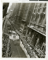
Photograph of Howard Hughes and his crew at a parade, New York, July 15, 1938
Date
1938-07-15
Archival Collection
Description
The view of Howard Hughes and his crew at a parade after he completed his Round-The-World flight in New York.
Image
Colburn's New Monthly Magazine and Humorist, no. 304. London: Chapman and Hall, 1846 April 01
Level of Description
Item
Archival Collection
Mavis Eggle "Books as They Were Bought" Collection
To request this item in person:
Collection Number: MS-01144
Collection Name: Mavis Eggle "Books as They Were Bought" Collection
Box/Folder: Box 05
Collection Name: Mavis Eggle "Books as They Were Bought" Collection
Box/Folder: Box 05
Archival Component
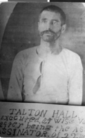
Postcard of Talton Hall, circa 1892
Date
1892
Archival Collection
Description
A protrait of Talton Hall. Beneath the portrait is an inscription: "Talton Hall, executed, at [Wise County, VA] after being the assassinator of [22 m?]"
Image