Search Results
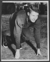
Photograph of track star, Boulder City, circa 1950s
Date
1950 to 1959
Archival Collection
Description
Boulder City High School unidentified track star.
Image
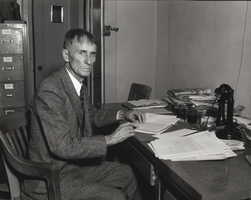
Photograph of Sims Ely, Boulder City, Nevada, 1931
Date
1931
Archival Collection
Description
The grayscale view of Sims Ely at his desk in an unknown building located in Boulder City, Nevada.
Image

Photograph of Sims Ely, Boulder City, Nevada, 1931
Date
1931
Archival Collection
Description
The grayscale view of Sims Ely at his desk in an unknown building located in Boulder City, Nevada.
Image
An Analysis of the Harry Allen Project; City of Boulder City, Nevada by Beck, R. W. & Associates, 1980 March
Level of Description
File
Archival Collection
Clark County Planning Commission Research Library Collection
To request this item in person:
Collection Number: MS-01027
Collection Name: Clark County Planning Commission Research Library Collection
Box/Folder: Box 83
Collection Name: Clark County Planning Commission Research Library Collection
Box/Folder: Box 83
Archival Component

Las Vegas City Commission Legal Documents, February 29, 1944 to February 21, 1945
Date
1944-02-29 to 1945-02-21
Archival Collection
Description
Bound volume of Las Vegas City Commission Legal Documents, February 29, 1944 to February 21, 1945
Text
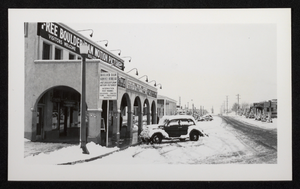
Photograph of Boulder Dam Service Bureau and Boulder City Theatre exteriors, Boulder City, Nevada, circa winter 1938-1939
Date
1938 to 1939
Archival Collection
Description
Exteriors of the Boulder Dam Service Bureau and Boulder City Theatre covered with snow. Snow-covered automobiles are parked on Arizona Street, and the Boulder Dam Hotel and the Union Bus Terminal can be seen in the distance.
Image
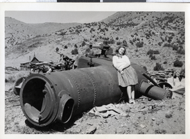
Photograph of Mound House in Carson City, Nevada, 1930s
Date
1930 to 1940
Archival Collection
Description
A picture of Mary Toleno posing next to the Mound House near Carson City.
Image
Hangar built by the U.S. Navy at the Boulder City Airport, Boulder City, Nevada, approximately 1931-1935
Level of Description
File
Archival Collection
L. F. Manis Photograph Collection
To request this item in person:
Collection Number: PH-00100
Collection Name: L. F. Manis Photograph Collection
Box/Folder: Folder 22
Collection Name: L. F. Manis Photograph Collection
Box/Folder: Folder 22
Archival Component