Search the Special Collections and Archives Portal
Search Results
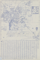
Official Arrow city map, Las Vegas & vicinity, Nevada, circa 1957-1961
Date
1957 to 1961
Description
71 x 68 cm. on sheet 106 x 71 cm., folded in cover 25 x 12 cm. Cover title: Latest edition, city map and street index of "fabulous" Las Vegas and vicinity, Nevada. Publisher from cover. "H-654-32." Includes indexes. Inside of cover includes information on Las Vegas. Includes inset maps of Boulder City, Nevada, and Las Vegas's location. Original publisher: R. L. Polk.
Image
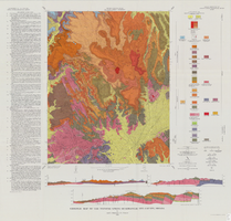
Geologic map of the Topopah Spring quadrangle, Nye County, Nevada, 1970
Date
1970
Description
58 x 46 cm., on sheet 84 x 88 cm., folded in envelope 30 x 24 cm. Relief shown by contours and spot heights. "Geology mapped in 1962-63." Includes description of map units, colored columnar section, 3 colored cross sections, and quadrangle location map. "Prepared in cooperation with the U. S. Atomic Commission." Original publisher: Interior, Geological Survey, Series: Geologic quadrangle map GQ, Scale: 1:24 000.
Image
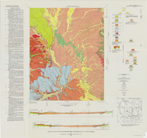
Geologic map of the Buckboard Mesa quadrangle, Nye County, Nevada, 1966
Date
1966
Description
58 x 46 cm., on sheet 87 x 91 cm., folded in envelope 30 x 24 cm. Relief shown by contours and spot heights. "Contour interval 20 feet." "Prepared in cooperation with the U.S. Atomic Energy Commission." "Geology mapped in 1962-63." Includes text, 2 col. cross sections, and 2 index maps. Original publisher: U.S. Geological Survey, Series: Geologic quadrangle map GQ, Scale: 1:24 000.
Image

Street map of the Las Vegas area, circa 1960
Date
1959 to 1960
Description
53 x 65 cm., folded to 22 x 9 cm. Panel title: Welcome map & established guide to the greater Las Vegas area and scenic routes to and from there. Includes index and advertisements for local businesses. Las Vegas Motel Association map on verso along with advertisements, information on the Las Vegas Convention Center, and sightseeing information. Map was probably distributed by the Las Vegas Chamber of Commerce. Library's copy has freeway, service road, and streets connecting to the freeway marked with different colors of crayon and includes notes. 1960 ed. Map is irregularly shaped. Original publisher: Las Vegas Motel Association.
Image
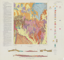
Geologic map of the Topopah Spring NW quadrangle, Nye County, Nevada, 1965
Date
1965
Description
58 x 47 cm., on sheet 84 x 89 cm., folded in envelope 30 x 24 cm. Relief shown by contours and spot heights. "Contour interval 20 feet." "Prepared in cooperation with the U. S. Atomic Energy Commission." "Geology mapped by R. L. Christiansen, P. W. Lipman, and H. R. Cornwall, 1962." Includes text, 3 col. cross sections, and quadrangle location map. Original publisher: Interior, Geological Survey, Series: Geologic quadrangle map GQ, Scale: 1:24 000.
Image
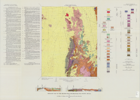
Geologic map of the Belted Peak quadrangle, Nye County, Nevada, 1967
Date
1967
Description
45 x 36 cm., on sheet 64 x 89 cm., fold. in envelope 30 x 24 cm. Relief shown by contours and spot heights. "Contour interval 40 feet." "Prepared in cooperation with the U.S. Atomic Energy Commission." "Geology mapped in 1962-63." Includes text, 2 col. cross sections, and quadrangle location map. Original publisher: U.S. Geological Survey, Series: Geologic quadrangle map GQ, Scale: 1:62 500.
Image
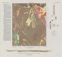
Geologic map of the Dead Horse Flat quadrangle, Nye County, Nevada, 1967
Date
1967
Description
58 x 46 cm., on sheet 77 x 84 cm., folded in envelope 30 x 24 cm. Relief shown by contours and spot heights. "Base by U.S. Geological Survey, 1960." "Geology mapped in 1962-64." "Contour interval 20 feet." Includes 2 col. cross sections, quadrangle location map, and text. "Prepared in cooperation with the U. S. Atomic Commission." Original publisher: Interior, Geological Survey, Series: Geologic quadrangle map GQ, Scale: 1:24 000.
Image
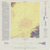
Geologic map of the Frenchman Flat quadrangle, Nye, Lincoln, and Clark Counties, Nevada, 1965
Date
1965
Description
58 x 47 cm., on sheet 81 x 81 cm., folded in envelope 30 x 24 cm. Relief shown by contours and spot heights. "Geology mapped in 1962. Contours on pre-Cenozoic rocks by D. L. Healey and C. H. Miller, 1958-63." Includes text, col. cross section and quadrangle location map. "Prepared in cooperation with the U.S. Atomic Energy Commission." Original publisher: Interior, Geological Survey, Series: Geologic quadrangle map GQ, Scale: 1:24 000.
Image
Pagination
Refine my results
Content Type
Creator or Contributor
Subject
Archival Collection
Digital Project
Resource Type
Year
Material Type
Place
Language
Records Classification

