Search the Special Collections and Archives Portal
Search Results
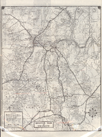
Road map of Hoover Dam and vicinity, circa 1949
Date
1947 to 1951
Description
'Cartography by W. C. Kainsinger, W.T. Taylor. Field mapping by K. R. Reed, G. Boyd. Typography by W. R. Williams.' 'Copyright by Automobile Club of Southern California. C-21351.' 'C-1352'--Panel. Index on verso. In lower right corner: 'Map number 1959.' Scale 1:415,210 (W 116°--W 114°/N 37°--N 35°). Relief shown by hachures and spot heights. Shows mines, ranches and springs. Not the same as the 1948 edition of this map. Cartographers', field mappers', typographers' names are different, and 2 out of 3 numbers on maps are different. Probably after 1947 as Boulder Dam has been changed to Hoover Dam, but before 1950 as Las Vegas Bombing and Gunnery Range has not been changed to Nellis Air Force Base. Automobile Club of Southern California.
Text
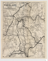
Map showing automobile routes to Hoover Dam and vicinity, circa 1934
Date
1930 to 1938
Description
'Prepared by the Automobile Club of Southern California.' 'burke' in lower right corner. '1352' in circle in lower left corner. Relief shown by hachures and spot heights. Shows mines, ranches, and springs. Scale [ca. 1:443,520] (W 115°30--W 114°--N 36°30/N 35°)
Image
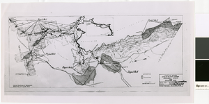
Map of irrigable areas near Boulder Dam, February 20, 1935
Date
1935-02-20
Archival Collection
Description
'Drawn by C.G.C.' 'Carson City, Nevada, Feb. 20, 1935. No. 4.' 'Adapted from Bureau of Reclamation's General map of irrigable areas.'
Image
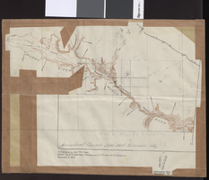
Topographic map of Arrow Canyon dam and reservoir site on the Muddy River, 1934
Date
1934
Archival Collection
Description
'Topography by Lee Morrison. Control by U.S. Geological Survey and U.S. Bureau of Reclamation. Surveyed in 1934.' Relief shown by contours and spot heights. 'Arrowhead Canyon Dam and reservoir site' hand-written on map. Map is part of a larger map and has been taped to a manila envelope sent from the Agricultural Administration to J.H. Wittwer on Sept. 25, 1939. Map has hand-drawn township and range lines and handwritten numbers. Verso has a hand-drawn map, calculations, and hand-written notes. U.S. Geological Survey
Text
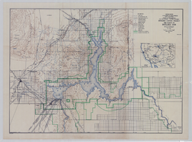
Topographic map of Boulder Canyon Project, Boulder Dam area, 1940
Date
1940
Description
Scale [ca. 1:221,760. 1 in. to approx. 3.5 miles] ; 1 map : col. ; 51 x 71 cm ; Relief shown by contours and spot heights ; Includes township and range grid ; "Map no. 40-40" ; Includes index map ; Shows power lines, triangulation stations, boundary monuments, roads, telephone lines, mines, bench marks, etc. ; U.S. Dept. of the Interior, Bureau of Reclamation
Image
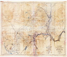
Topographic map of Boulder Canyon Project, Hoover Dam area, 1932
Date
1932
Description
Scale [ca. 1:221,760. 1 in. to approx. 3.5 miles] ; 1 map : col. ; 51 x 62 cm ; Relief shown by contours and spot heights ; "Prepared in Washington Office from compilation made in Las Vegas Office." ; "Map no. 24000." ; Includes township and range grid ; Shows power lines, triangulation stations, boundary monuments, roads, telephone lines, mines, bench marks, etc. ; Department of the Interior, Bureau of Reclamation.
Image
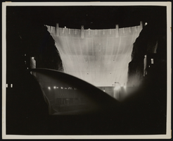
Photograph of dam at night, Hoover Dam, 1934-1936
Date
1934 to 1936
Archival Collection
Description
A night time view of the Hoover Dam. Site Name: Hoover Dam (dam)
Image
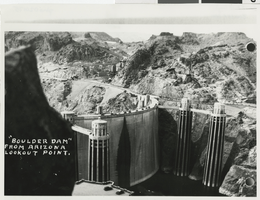
Photograph of Boulder Dam (Hoover Dam), 1940s
Date
1940 to 1949
Archival Collection
Description
Black and white photograph of Lake Mead and Boulder Dam (now called Hoover Dam). View of Boulder Dam from Arizona lookout point. Possibly a postcard.
Image
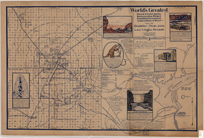
Map of Boulder Dam area and Las Vegas, Nevada, October 7, 1930
Date
1930-10-07
Description
'F.V. Owen, publisher ... Los Angeles, California. Topography by C.H. Fenner, C.E. Decorations by L.J. Bergère. Gov't. data, H.A. Shamberger, C.E. Copyright, 1930, by F.V. Owen.' At bottom right of map: 'Dated Oct. 7th, 1930.' Relief shown by contours and spot heights. Contour lines are 100 feet. Incudes six hand-colored illustrations showing local points of interest. Includes information on Hoover Dam, and chart of mileages from Las Vegas. Scale [ca. 1:63,360]. 1 inch to 1 mile
Text
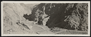
Photograph of dam site, Hoover Dam, January 1933
Date
1933-01
Archival Collection
Description
Looking upstream at the dam site, Hoover Dam, January 1933. Construction materials and small bridges line the canyon above the river as the dam is being built.
Image
Pagination
Refine my results
Content Type
Creator or Contributor
Subject
Archival Collection
Digital Project
Resource Type
Year
Material Type
Place
Language
Records Classification
