Search Results
Hotel Nevada, Las Vegas, Nevada, photograph and negative, approximately 1930 to 1931
Level of Description
Archival Collection
Collection Name: Elton and Madelaine Garrett Photograph and Architectural Drawing Collection
Box/Folder: Folder 05, Box 19
Archival Component
Nancy Wier Papers on Rock Art in Southern Nevada
Identifier
Abstract
The Nancy Wier Papers on Rock Art in Southern Nevada (approximately 1930-2003) contain photographs, notes, research, and publications focused on rock art (rock writing) found in the Southern Nevada Region. Wier founded the Southern Nevada Rock Art Enthusiasts (SNRAE) in 1992, and the photograph albums document trips across Nevada, Southern California, Utah, and Arizona. The photograph albums are grouped by site location, and the description was taken directly from Wier's albums. The majority of the collection documents rock writings in Southern Nevada.
Archival Collection
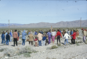
Slide of protesters near the Nevada Test Site, 1983
Date
Archival Collection
Description
Image
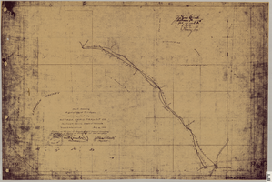
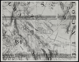
Map showing right of way of toll road constructed by Nevada Rapid Transit Co. in Lincoln County (Nev.), 1905
Date
Description
Image
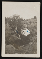
Hazel Denton and Allene crouched in bushes in Nevada: photographic print
Date
Archival Collection
Description
Image
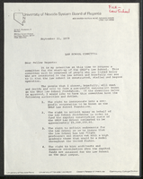
Letter to Board of Regents proposing University of Nevada, Las Vegas law school committee
Date
Archival Collection
Description
Folder contains a letter from Regent James L. Buchanan II to fellow Nevada System Regents proposing "a committee for the start-up of UNLV's Law School." From the University of Nevada, Las Vegas William S. Boyd School of Law Records (UA-00048).
Text
Topographic map of Nevada and California: map
Date
Description
Image
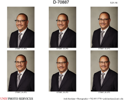
Nevada System of Higher Education interim chancellor John V. White: digital photographs
Date
Archival Collection
Description
Image

Valeria Gurr, Nevada Institute for Children on November 24, 2015: digital photographs
Date
Archival Collection
Description
Image

Geologic map of Las Vegas Valley, Nevada, 1982
Date
Description
Image