Search Results
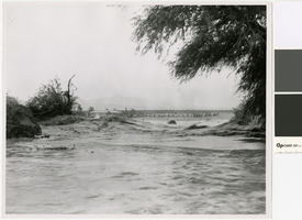
Photograph of flooding in the Nevada desert, circa 1950
Date
Archival Collection
Description
Flooding in the desert
Transcribed Notes: Transcribed from photo sleeve: "Unidentified location in flood
Image
University of Nevada, Las Vegas (UNLV) 29th commencement program
Date
Archival Collection
Description
Commencement program from University of Nevada, Las Vegas Commencement Programs and Graduation Lists (UA-00115).
Text

Topographic map of groundwater in the southwest quadrangle of Las Vegas, Nevada, 1985
Date
Description
Text
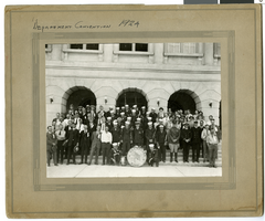
Photograph of the U.S.S. Nevada Band, 1924
Date
Archival Collection
Description
Image
University of Nevada, Las Vegas Division of Student Affairs Records
Identifier
Abstract
University of Nevada, Las Vegas Division of Student Affairs Records contains reports on student demographics and usage statistics of the Student Services program, as well as inter-departmental correspondence that date between 1958 and 1979. The collection also contains correspondence with external departments, committees, and professors. The majority of the correspondence is dated between 1970 and 1977 and is primarily from Dr. Robert E. Glennen, UNLV's Vice President for Educational Services at the time. The collection also contains student handbooks, codes of conduct, Greek Life information, Moyer Student Union newsletters and brochures, and other student-related material.
Archival Collection
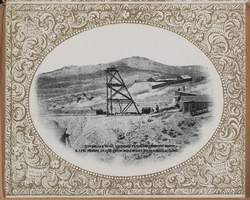
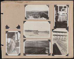
"Souvenir of Tonopah, Nevada" with photos from Goldfield, Tonopah, and Searchlight, Nevada: photograph album, image 036
Description
Jewish Community Center of Southern Nevada, item 01
Description
Thank-you letter from Sue Rudden, Vice President and Membership Chairman of the Jewish Community Center of Southern Nevada.

The Nevada System of Higher Education (NSHE) says goodbye to regents Robert Blakely and Jack Lund Schofield December 5, 2014 at the University of Nevada, Las Vegas: digital photographs
Date
Archival Collection
Description
Image
Southern Nevada Photo Album, image 048
Description
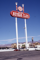
Del Webb's Nevada Club double mounted pylon and lettering signs, Laughlin, Nevada: photographic print
Date
Archival Collection
Description
Exterior view of Del Webb's Nevada Club before it was sold and remodeled into the Golden Nugget.
Image