Search Results

Aerial view of the Nevada Test Site: photographic slide
Date
Archival Collection
Description
From the Sister Klaryta Antoszewska Photograph Collection (PH-00352)
Image

Aerial view of the Nevada Test Site: photographic slide
Date
Archival Collection
Description
From the Sister Klaryta Antoszewska Photograph Collection (PH-00352)
Image
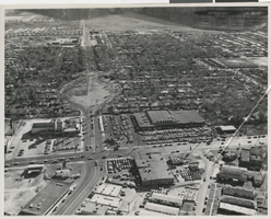
Aerial photograph of Maryland Parkway and Charleston Boulevard, Las Vegas (Nev.), 1964
Date
Archival Collection
Description
Image
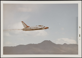
Thunderbirds aerial performance in Alamo, Nevada: photographic print
Date
Archival Collection
Description
Image
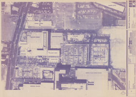
Diazotype of aerial photograph of the Holiday Casino (Las Vegas), circa 1986
Date
Archival Collection
Description
Aerial photograph of the Holiday Casino complex and surrounding properties on on the Las Vegas Strip. Properties and buildings are labeled. The Holiday Casino complex became Harrah's Las Vegas in 1992.
Site Name: Holiday Casino
Address: 3475 Las Vegas Boulevard South
Image
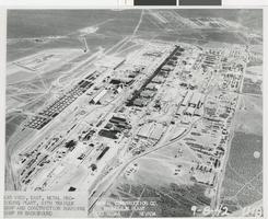
Aerial photograph of the Basic Magnesium Inc. plant, Henderson (Nev.), September 8, 1942
Date
Archival Collection
Description
Image
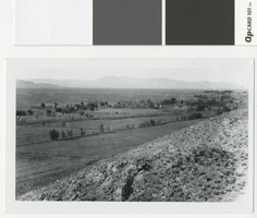
Aerial photograph of Alamo, Nevada, from an overlooking hill, circa 1922
Date
Archival Collection
Description
Alamo, Nevada from an overlooking hill
Transcribed Notes: Transcribed from back of photo: "About 1922 - Alamo - Looked like this."; Transcribed from photo sleeve: "An aerial of Alamo, Nevada ca. 1922"
Image
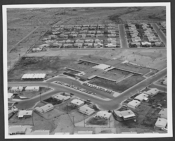
Aerial photograph of Jo Mackey Elementary School, North Las Vegas, Nevada, circa 1960s-1970s
Date
Archival Collection
Description
Image
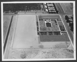
Aerial photograph of Quannah McCall Elementary School, North Las Vegas, Nevada, circa 1960s-1970s
Date
Archival Collection
Description
Image
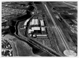
Aerial photograph of Hughes Airport, Culver City, California, circa early 1960s
Date
Archival Collection
Description
Image