Search Results
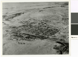
Aerial photograph of Las Vegas looking northeast, circa 1931
Date
Archival Collection
Description
Aerial view of Las Vegas looking northeast
Transcribed Notes: Transcribed from photo sleeve: "Aerial view of Las Vegas, 1931. Center foreground are the Union Pacific R.R. Co. shops with two tall standpipes. Las Vegas High School, gym, and adjoining Butcher Memorial Football Field are at the right of center."
Image

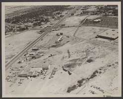
Aerial photograph of part of the Las Vegas Valley, Las Vegas, Nevada, circa 1963
Date
Archival Collection
Description
Image
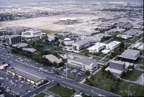
Slide of aerial view of University of Nevada, Las Vegas campus, circa 1983
Date
Archival Collection
Description
Image
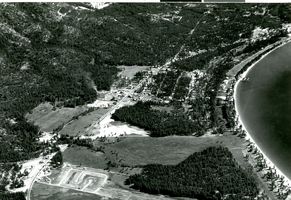
Aerial photograph of Stateline, Nevada and Lake Tahoe, circa 1961
Date
Archival Collection
Description
Aerial view of Stateline, Nevada.
Site Name: Lake Tahoe
Address: Stateline; Douglas County; Nevada
Image
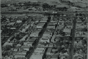
Black and white aerial view of Las Vegas.
Date
Description
Arrangement note: Series V. Glass slides
Image
Aerial photograph of the North Las Vegas Public Library and surrounding areas, June 5, 1973
Date
Archival Collection
Description
Image

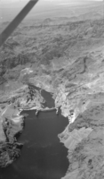
Film transparency showing an aerial view of Hoover Dam, circa late 1930s
Date
Archival Collection
Description
Image
Film transparency showing an aerial view of Hoover Dam, circa late 1930s
Date
Archival Collection
Description
Image

Photograph of two Thunderbirds planes performing aerial stunts, 1980
Date
Archival Collection
Description
Image
Aerial views of the Dunes golf course and the airport: video
Date
Archival Collection
Description
Aerial views of McCarran International Airport and repeated 360 views of the Dunes golf course and surrounding area. Original media 1 Inch SMPTE Type B, color, aspect ratio 4 x 3, frame size 720 x 486. From The Production Company Audiovisual Collection (MS-00930) -- Digitized audiovisual material file.
Moving Image