Search Results
Photograph of World War I draftees leaving Las Vegas, Nevada, 1918
Date
1918
Archival Collection
Description
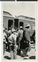
People outside of railroad passenger cars. Handwritten description given with photograph: "SP, LA & SL station [street side] with draftees WWI Las Vegas. Sequence of farewell scenes with views of cars. At least one car still lettered 'Salt Lake'."
Image
Photograph of World War I draftees leaving Las Vegas, Nevada, 1918
Date
1918
Archival Collection
Description
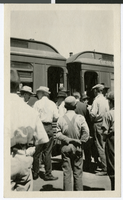
People outside of railroad passenger cars. Handwritten description given with photograph: "SP, LA & SL station [street side] with draftees WWI Las Vegas. Sequence of farewell scenes with views of cars. At least one car still lettered 'Salt Lake'."
Image
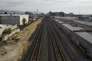
Section of Union Pacific Railroad tracks, Las Vegas, Nevada: digital photograph
Date
2017-05-31
Archival Collection
Description
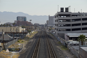
A section of the Union Pacific Railroad tracks heading northbound lay near the intersection of West Sahara Avenue and South Industrial Road.
Image
Section of Union Pacific Railroad tracks, Las Vegas, Nevada: digital photograph
Date
2017-05-31
Archival Collection
Description
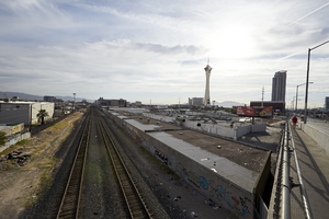
A section of the Union Pacific Railroad tracks lay west of the Las Vegas Strip near the intersection of West Sahara Avenue and South Industrial Road. The Stratosphere can be seen in the background as well as the Allure condominium complex.
Image
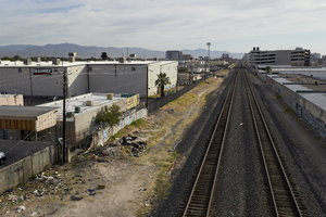
Section of Union Pacific Railroad tracks, Las Vegas, Nevada: digital photograph
Date
2017-05-31
Archival Collection
Description
A section of the Union Pacific Railroad tracks lay west of the Las Vegas Strip near the intersection of West Sahara Avenue and South Industrial Road. The Stratosphere can be seen in the background as well as the Allure condominium complex.
Image
Section of Union Pacific Railroad tracks, Las Vegas, Nevada: digital photograph
Date
2017-05-31
Archival Collection
Description
A section of the Union Pacific Railroad tracks heading northbound lay near the intersection of West Sahara Avenue and South Industrial Road.
Image

Section of Union Pacific Railroad tracks, Las Vegas, Nevada: digital photograph
Date
2017-05-31
Archival Collection
Description
A section of the Union Pacific Railroad tracks heading northbound lay near the intersection of West Sahara Avenue and South Industrial Road.
Image
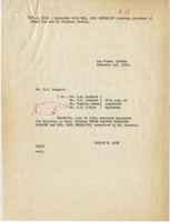
Agreement with Mrs. Carl Shurtliff covering purchase of water for use at Overton, Nevada, February 13, 1949
Date
1949-02-03
Archival Collection
Description
Contract between Mrs. Shurtliff and the Union Pacific for the railroad to supply water (N. L. D. 2131)
Text
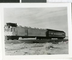
Photograph of the gas-electric railroad car number 99, Nevada, 1907-1930
Date
1907 to 1930
Archival Collection
Description
A picture of Tonopah and Tidewater gas-electric no. 99 hauling a sleeper toward Cucero on the Union pacific Railroad.
Image

Photograph of Word War I draftees leaving Las Vegas, Nevada Depot, 1918
Date
1918
Archival Collection
Description
People in front of railroad station. Handwritten description by Dave Coons given with photograph: "SP,LA & SL station, [street side] with draftees WWI Las Vegas. Sequence of farewell scenes with views of cars. At least one car still lettered 'Salt Lake.'" Another description given with photograph: "First contingent of draftees leaving Las Vegas Depot, 1918."
Image