Search the Special Collections and Archives Portal
Search Results
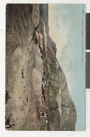
Postcard of the Montana Tonopah Mine, Tonopah (Nev.), 1900-1920
Date
1900 to 1920
Archival Collection
Description
An illustrated postcard of Montana-Tonopah Mine. Site Name: Montana-Tonopah Mine (Tonopah, Nev.)
Image
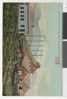
Postcard of the Consolidated Cal. & Virginia Shaft, Virginia City (Nev.), 1930s
Date
1930 to 1939
Archival Collection
Description
An illustrated postcard of the Virginia City Consolidated California and Virginia Shaft.
Image

Postcard of an open-pit copper mine, Ruth (Nev.), 1970s
Date
1970 to 1979
Archival Collection
Description
View from the rim of the copper pit. Ruth was a settlement built in 1903 for workers of the White Pine Copper Company.
Image
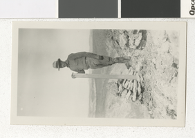
Photograph of C. D. Baker at a mining claim, 1920s-1930s
Date
1920 to 1939
Archival Collection
Description
C.D. Baker standing at a mining claim. This photograph may have been taken in Nevada.
Image
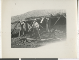
Photograph of a person in a mine, early 1900s
Date
1920 to 1940
Description
An individual poses in front of a mine in a desert. This photograph wad most likely taken somewhere in Nevada.
Image
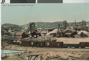
Postcard of Mohawk Mine, Goldfield (Nev.), 1905
Date
1905
Archival Collection
Description
Original color postcard featuring the Mohawk Mine, Goldfield , Nev. 1905. The Mohawk was known as "One of the richest pieces of ground in Nevada. If not the World." Production exceeded $8,000,000 before the mine became part of the Goldfield Consolidated Mining Company in late 1906.
Image
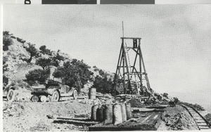
Postcard of the Harmill silver-lead mine, Montezuma (Nev.), 1929
Date
1929
Archival Collection
Description
The Harmill was being operated by Gerald B. Hartley, Sr. and was worked through the 1930s. (Gerald B. Hartley, Jr. Collection) There was an inscription on the image. "The Montezuma district was laid out after the discovery of ore in the area on May 24, 1867 by Thomas Nagle, Mat Plunkett, and a Mr. Carlyle. The district was active through the 1880s after which mining came to a standstill. Montezuma experienced a revival in the early 1900s on the heels of the Goldfield boom. Mining continued through the 1930s from operations such as the Harmill. Ore was chiefly silver accompanied by lead with some gold. Recorded production from the district was over $500,000."
Image
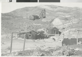
Postcard of Klondyke (Nev.), 1963
Date
1963
Archival Collection
Description
Located 10 miles southeast of Tonopah, the camp was settled in the late 1890s when silver and gold was discovered in the area. In May, 1900, when Jim Butler picked up his first samples at the site that would become Tonopah, he was en route to Klondyke. He offered the local assayer, Frank Higgs, an interest in the find for an assay, but Higgs declared the samples worthless and threw them out. Fortunately, Butler retrieved more samples on this return trip to Belmont. The building on the right with the large smoke-stack was the assay office. None of the structures remain today.
Image
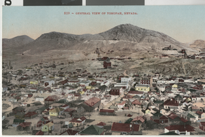
Postcard of Tonopah (Nev.), 1905
Date
1905
Archival Collection
Description
Original color postcard of Tonopah, Nevada, 1905. The district's major mines appear on Mount Oddie in the background. At the time the population of the town was over 4,000 and the mines were producing in excess of $230,000 a month. Tonopah went on to become one of the state's largest silver producers.
Image
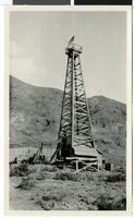
Photograph of mining tower, Rhyolite (Nev.), circa 1925
Date
1924 to 1926
Archival Collection
Description
The view of a mining tower between Mountain Ladd and Montgomery Mountain in Rhyolite, Nevada. Handwritten description provided on back of image: "between Mt. Ladd and Montgomery Mt. out in the middle of the alluvium. Tower documents attempt to reach bedrock. They went down 350 feet and didn't get to bedrock. See USGS Bulletin 407. - Ed Whipple, 12/19/78."
Image
Pagination
Refine my results
Content Type
Creator or Contributor
Subject
Archival Collection
Digital Project
Resource Type
Material Type
Place
Language
Records Classification
