Search Results
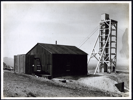
Photograph of New York Tonopah Mine, Tonopah (Nev.), early 1900s
Date
Unknown year in the decade of the 1900s
Archival Collection
Description
Photograph of New York Tonopah Mine, Tonopah (Nev.), early 1900s
Image
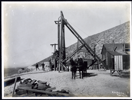
Photograph of miners at North Star Mine, Tonopah (Nev.), early 1900s
Date
Unknown year in the decade of the 1900s
Archival Collection
Description
Photograph of miners at North Star Mine, Tonopah (Nev.), early 1900s
Image
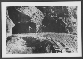
Photograph of Ed Carbary at Potosi Mine, Nevada, circa late 1800s to early 1900s
Date
1870 to 1939
Archival Collection
Description
Ed Carbary standing at the entrance to Potosi Mine in Nevada.
Image
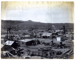
Photograph of Mohawk Mine and surroundings, Goldfield (Nev.), early 1900s
Date
Unknown year in the decade of the 1990s
Archival Collection
Description
Inscription on back reads: "The wagon in the middle foregroundshows a dray hauling one of our 50 HP motors to the "Frances Mohawk" lease which is shown on the extreme left. This lease and the one in the center (the "Hayes-Monnetta") are each taking out over $40,000 per day. The houses in the distance are lying between Goldfield and Columbia. The large white building to the right and back is the Nevada Goldfield Reduction Works. The R.R. station is to the rear and left."
Caption: Mohawk Mine Goldfield, Nev. early 1900s. Railroad station to the rear and left.
Caption: Mohawk Mine Goldfield, Nev. early 1900s. Railroad station to the rear and left.
Image
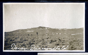
Photograph of the Daisy Mine and camp, 1900-1920
Date
1900 to 1920
Archival Collection
Description
Caption: Daisy-Diamondfield
Image
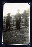
Photograph of men guarding sacked ore, Round Mountain (Nev.), early 1900s
Date
1900 to 1925
Archival Collection
Description
Photograph of men guarding sacked ore, Round Mountain (Nev.), early 1900s
Image
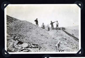
Photograph of men working at hillside mine, Round Mountain (Nev.), early 1900s
Date
1900 to 1925
Archival Collection
Description
Photograph of men working at hillside mine, Round Mountain (Nev.), early 1900s
Image
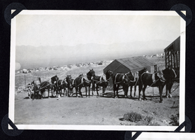
Photograph of packtrain and horse team at mine, Round Mountain (Nev.), early 1900s
Date
1900 to 1925
Archival Collection
Description
Photograph of packtrain and horse team at mine, Round Mountain (Nev.), early 1900s
Image
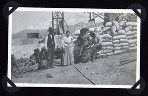
Photograph of people standing with sacked ore, Round Mountain (Nev.), early 1900s
Date
1900 to 1925
Archival Collection
Description
Photograph of people standing with sacked ore, Round Mountain (Nev.), early 1900s
Image

Photograph of man examining specimen at mine, Round Mountain (Nev.), early 1900s
Date
1900 to 1925
Archival Collection
Description
Photograph of man examining specimen at mine, Round Mountain (Nev.), early 1900s
Image