Search Results
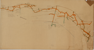
Map of the Red Top Mine, 4th level, Esmeralda County (Nev.), 1900-1925
Date
1900 to 1925
Description
Sectional mining map; hand-drawn and annotated in colored pencil
Image
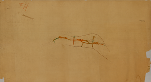
Map of the Red Top Mine, 1st level, Washoe County (Nev.), 1900-1925
Date
1900 to 1925
Description
Sectional mining map; hand-drawn and annotated in colored pencil
Image
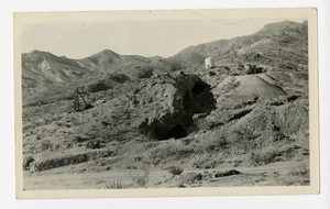
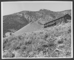
Photograph of the hillside and surface stopes at the Wall Street Mine, Eldorado Canyon (Nev.), 1900-1925
Archival Collection
Description
Inscription on back reads: Room and pillar surface stopes stopes on the Wall Street Mine-which produced $1,5000,000.00 in gold alone from about 80 feet depth. El Dorado Canyon Clark County Nevada
Image
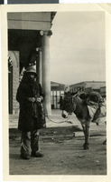
Photograph of a prospector, Reno, Nevada, 1900-1930
Date
1900 to 1930
Archival Collection
Description
A picture of a prospector and his burro in front of the First State Bank.
Image
Photograph of West End Chemical Mine, 1925
Date
1925
Archival Collection
Description
West End Chemical Mine, 1925.
Image
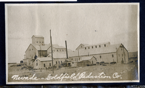
Photograph of the Nevada-Goldfield Mill operations, Goldfield (Nev.), 1900-1920
Date
1900 to 1920
Archival Collection
Description
Caption: Nevada-Goldfield Reduction Co.
Image
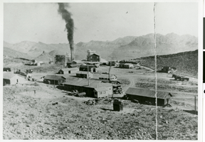
Photograph of mining site, Eureka, Nevada, circa early 1900s
Date
1900 to 1910
Archival Collection
Description
Eureka, Nevada mining site.
Image
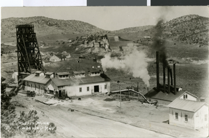
Postcard of Morris Mine, Kimberley, Nevada, circa early 1900s
Date
1900 to 1939
Archival Collection
Description
A bird's eye view of Morris Mine in Kimberley, Nevada.
Image
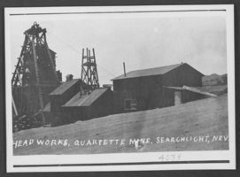
Photograph of Quartette Mine, Searchlight, Nevada, circa early 1900s
Date
1900 to 1910
Archival Collection
Description
Description provided with image: "Head works, Quartette Mine, Searchlight, Nevada."
Image
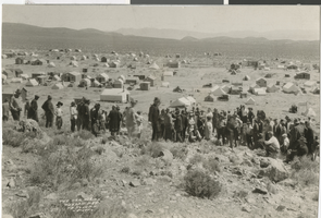
Photograph of the new strike, Weepah, Nevada, circa early 1900s
Date
1900 to 1939
Archival Collection
Description
The new strike in Weepah, Nevada. Individual Creator credit goes to N. E. Johnson Photo.
Image