Search Results

Photograph of open pit mine, Ruth, Nevada, 1934
Date
1934
Archival Collection
Description
Open pit mine.
Image
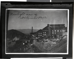
Photograph of Delamar Mill, Nevada, circa late 1800s
Date
1890 to 1899
Archival Collection
Description
Black and white image of Delamar Mill. Transcribed from image: "Moonlight view of Delamar Mill."
Image
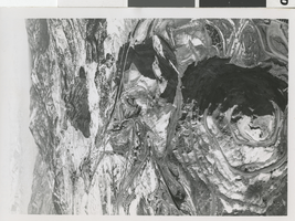
Aerial photograph of mining pits, Nevada, 1960-1961
Date
1960 to 1961
Archival Collection
Description
An aerial view looking east shows the Veteran Pit in foreground, the Tripp Pit in the center, and the huge Liberty Pit in the background.
Image
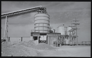
Mining operation in the Amargosa Valley, Nevada: photographic print
Date
1982
Archival Collection
Description
From the UNLV Libraries Single Item Accession Photograph Collection (PH-00171). Photo by Ken Bouton.
Image
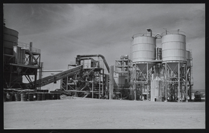
Mining operation in the Amargosa Valley, Nevada: photographic print
Date
1982
Archival Collection
Description
From the UNLV Libraries Single Item Accession Photograph Collection (PH-00171). Photo by Ken Bouton.
Image

Mining operation in the Amargosa Valley, Nevada: photographic print
Date
1982
Archival Collection
Description
From the UNLV Libraries Single Item Accession Photograph Collection (PH-00171). Photo by Ken Bouton.
Image
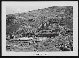
Smelter foundation at Candelaria Mine, Nevada: photographic print
Date
1967-06
Description
From the Nan Doughty Photograph Collection (PH-00240)
Image
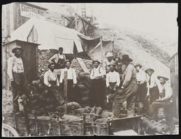
Miners with sacked ore in Rawhide, Nevada: photographic print
Date
1909 (year approximate)
Description
From the Nan Doughty Photograph Collection (PH-00240). Shaffer Lease, Grutt Hill Mill.
Image
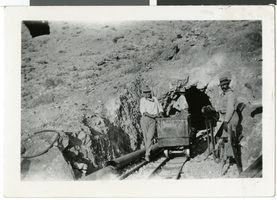
Photograph of men at Frenchman Mine, Nevada, circa 1907
Date
1905 to 1909
Archival Collection
Description
Men with ore cart at adit to Frenchman Mine. Man at the left may be Earl Rockwell.
Image
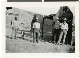
Photograph of men at Frenchman Mine, Nevada, circa 1908
Date
1906 to 1910
Archival Collection
Description
Joe Casablanca, Frenchy [?], Spud Lake, and Earl Rockwell with a dog at Frenchman Mine.
Image